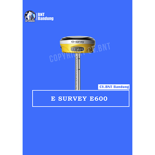
GPS E-Survey E600
The new e-survey E600 GNSS Receiver is coming to change the scene in the high-end GNSS receiver market. With up to 800 true channels and surprising performance, it is destined to be the perfect ally of the topographer – and not only – in the pursuit of perfection.
E600 supports all the new technologies (Tilt Survey, Voice Guidance, Audible Approach Alerts, etc.). It uses all satellite signals (through RTCM32 protocol), has a built-in UHF modem, and is small, compact and lightweight. It’s biggest advantage? The unique Android SurPad 4.0 application which we offer completely free of charge to our customers with the purchase of the receiver.
Specifications Gps eSurvey E600
- General
Weight 2.7 lbs (1.2 kg)
Dimensions ø6.2 x 3 in (ø156 x 76 mm)
- Temperature
Operating -49°F to 149°F (–45°C to 65°C)
Storage -58°F to 176°F (–50°C to 80°C)
- Battery/Power
Battery Life Up to 10 hours
Power Source Dual 3400 mAh Rechargeable Batteries
Voltage 7.2 V
- Tracking Features
Satellites GPS / GLONASS / BeiDou / Galileo / NAVIC / SBAS / QZSS
Channels Up to 600
Antenna Internal
Range Up to 5 km
- Accuracy
RTK H: 4 mm + 1 ppm RMS / V: 8 mm + 1 ppm RMS
Static H: 2mm + 0.1 ppm / V: 33 mm + 0.4 ppm
SBAS H: 0.6 m RMS
- Memory
On-Board 8 GB
Expandable Yes
- Communication Interface
Bluetooth V2.1+EDR / V4.1 Dual Mode, Class 2
Cellular GSM / GPRS / EDGE / LTE / UMTS / WCDMA
Wireless LAN 802.11 b/g/n
Internal UHF 410 – 470 MH
Fitur Gps Geodetik Survey E600
- Beberapa papan lanjutan opsional termasuk 600 saluran Hemisphere P328, Trimble BD990 dan 555 saluran Novatel OEM729 untuk diversifikasi untuk skenario survei yang kompleks.
- Trek konstelasi penuh menyampaikan GPS / BDS / GLONASS / GALILEO, mendukung 4G, Bluetooth, komunikasi nirkabel.
- Koneksi penuh yang kompatibel dan protokol radio dengan penerima GNSS utama.
- Unique Atlas L-band SBAS, mampu memposisikan sentimeter di medan terpencil tidak peduli laut, Gobi dan Gurun. Solusi yang berarti untuk pertanian dan survei.
- Hotswap baterai eksternal ganda hingga 8 jam operasi, pemeriksaan jarak jauh dan peringatan pangkalan bergerak.
- Kompensasi survei Tilt dengan internal E-bubble, opsional pemasangan sensor Tilt, data diperoleh melalui Taruhan yang sederhana, Swing dan stop.
- Menyimpan data cadangan otomatis.