Results for "south"

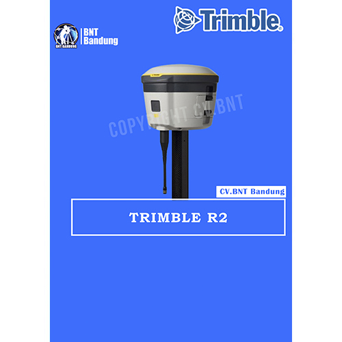
GPS Geodetik RTK GNSS Trimble R2

The Trimble® R2 is a compact, durable GNSS receiver that provides an easy-to-use solution for GIS and survey professionals who need to collect highly accurate data in a wide range of geospatial applications. Capable of delivering between submeter and centimeter positioning accuracy in real-time to any mobile device via a wireless Bluetooth® connection, the R2 receiver gives you total flexibility to choose a solution based on the accuracy and GNSS performance level that suits your application, letting you work the way you want.

  • Professional solution for GIS & survey applications ranging from submeter to centimeter accuracies
  • Easily collect data by pairing with devices such as smartphones, tablets or Trimble handhelds
  • Fast to setup, easy-to-use, keeping you productive and focused on your work
  • Supports multiple satellite constellations and correction sources for accurate data at any location
  • Compact, cable-free design with integrated antenna

High accuracy for survey & GIS applications

  • Capable of delivering submeter to centimeter level positioning accuracy in real-time to suit any field data collection application.
  • Achieve higher accuracy in real-time using correction sources from SBAS and VRS networks to Trimble RTX™ correction services*, delivered by either satellite or Internet, or via traditional RTK methods.
  • Supports multiple satellite constellations and augmentation systems to provide maximum accuracy and positioning performance.

* Trimble RTX available through Trimble applications

Flexible solution

  • Able to be paired with any mobile device on a variety of operating systems and platforms, from a Trimble handheld or controller to a modern smartphone or tablet.
  • You can select the accuracy and GNSS performance level appropriate for your application.
  • Capable of being operated either mounted on a pole, on a backpack or on a vehicle.
  • Integrates with Trimble software such as Trimble Access™, Trimble TerraFlex™ and Trimble Business Center to enable data to be easily collected, communicated and processed, providing you with high-quality deliverables for your organization.

Simple, rugged system

  • One-button start up and compact, streamlined design enables a quick setup.
  • Built to withstand tough conditions meeting military specifications MIL-810G for ruggedness and an IP65 rating.


Note:
*Harga Dapat Berubah Sewaktu – waktu tanpa pemberitahuan terlebih dahulu.
*Mohon tanya ketersediaan barang terlebih dahulu.


GPS Geodetik RTK GNSS Stonex S800A

Stonex S800A is a compact, high-performance GNSS receiver with unique features and unmatched in its category. The S800A features the multi constellation 600 channels GNSS board and supports GPS, GLONASS, BEIDOU, GALILEO, including L-Band correction.

The unique internal antenna combines GNSS, Bluetooth and Wi-Fi integrated modules to optimize space and increase performance. This technology provides stronger and cleaner signal monitoring, which means unprecedented results.
Designed for all day use in surveying application, S800A includes several features: Linux Operating System, WEB UI interface, UHF radio modem, high battery capacity and IP67 certification.

Stonex S800A GNSS receiver, thanks to aRTK function and service of Atlas® correction is an ideal solution for any surveying field work and in particular in difficult areas. Atlas® delivers world wide centimetre level correction data through L-band communication satellites and internet.

GPS Geodetik RTK GNSS Stonex S10

Spesifikasi Dan Fitur Gps Geodetik Stonex S10 GNSS Receiver RTK

Deskripsi:

The New Generation GNSS Receiver
Stonex S10, the most advanced integrated GNSS Receiver ever appeared on the geomatic scene, leads to a new generation of smart and open GPS, where the User has the ability to install customized applications directly on the receiver.

The advanced features of Stonesx S10, such as automatic leveling with electronic bubble, make surveying much faster and accurate.

The sophisticated internal structure design guarantees a compact housing: GNSS antenna, GPS board, power board, RX/TX radio, smart battery, 3.5G module, BT module and Wi-Fi module all take place in a well organized space, optimizing performances and power consumption.

Stonex S10 is based on CORTEX-A8 platform with on board LINUX smart system combined with an excellent networking system. With the provision of a special SDK package it is possible to develop and install special applications that run inside S10 ecosystem, enabling an unlimited range of advanced applications.

Fitur:

  • MULTI CONSTELLATION Stonex S10 with its 220 channels, provides an excellent on board real time navigation solution with high accuracy. All GNSS signals (GPS, GLONASS, BEIDOU and GALILEO) are included, no additional cost.
  • WEB UI CONTROL To initialize, manage, monitor the settings of the receiver and to download data using portable or PC, smartphone or tablet.
  • TILT CENTERING Its possible to measure points with inclination up to 30. The tilt compensator installed inside can automatically correct the coordinates of the points collected in accordance with the tilt angle and tilt direction of the range pole.
  • TWO INTELLIGENT BATTERIES Stonex S10 is delivered with two high capacity smart batteries. The power level can be checked from the controller and directly from a simple led bar on the battery by the simple press of a button.
  • RUGGED DESIGN IP67 PROTECTION IP67 certification, combined with a high shock resistance guarantee the maximum strength and the best water and dust tight even in harsh environments.


LEICA VIVA GS25

Perangkat lunak yang menarik

Receiver Leica Viva GS10 dan GS25 hadir dengan perangkat lunak Leica Captivate yang revolusioner , mengubah data kompleks menjadi model 3D yang paling realistis dan dapat diterapkan. Dengan aplikasi yang mudah digunakan dan teknologi sentuh yang familier, semua bentuk data terukur dan desain dapat dilihat dalam semua dimensi. Captivate mencakup industri dan aplikasi hanya dengan satu gesekan sederhana, terlepas dari apakah Anda bekerja dengan GNSS, total station, atau keduanya.

Kemungkinan tak terbatas

Saat Captivate menangkap dan memodelkan data di lapangan, perangkat lunak Leica Infinity memproses informasi tersebut kembali di kantor. Transfer data yang lancar memastikan proyek tetap berjalan pada jalurnya. Captivate dan Infinity bekerja sama untuk menggabungkan data survei sebelumnya dan mengedit proyek dengan lebih cepat dan efisien.

Layanan pelanggan dengan sekali klik
Melalui Layanan Pelanggan Aktif, jaringan global profesional berpengalaman hanya dengan sekali klik untuk memandu Anda secara ahli mengatasi masalah apa pun.

  • Hilangkan penundaan dengan layanan teknis yang unggul
  • Selesaikan pekerjaan lebih cepat dengan dukungan konsultasi yang sangat baik
  • Hindari kunjungan ulang ke lokasi yang mahal dengan layanan online untuk mengirim dan menerima data langsung dari lapangan

Kendalikan biaya Anda dengan Paket Layanan Pelanggan yang disesuaikan, memberi Anda ketenangan pikiran bahwa Anda terlindungi di mana saja, kapan saja.

Perangkat genggam yang kuat

Dalam pengontrol atau tablet, bawa seluruh kantor Anda saat bepergian saat Anda menemukan kekuatan untuk mengatasi lingkungan apa pun dari telapak tangan Anda. Pengontrol Leica CS20 dan tablet Leica CS35 memberikan kendali dan kenyamanan tertinggi dengan mobilitas lengkap. Teknologi layar sentuh memungkinkan pemrosesan data yang nyaman dan cepat sementara tampilan 3D yang menakjubkan mengubah pengalaman Leica Viva GNSS Anda.

Note:
*Harga Dapat Berubah Sewaktu – waktu tanpa pemberitahuan terlebih dahulu.
*Mohon tanya ketersediaan barang terlebih dahulu.

LEICA Viva GS18

You can forget the bubble when you use the Leica GS18 T. It is the original truly tilt compensating GNSS solution that is immune to magnetic disturbances and is calibration-free. The sensor fusion of GNSS and Inertial Measurement Unit (IMU) creates the original true tilt compensating GNSS smart antenna. For GS18, T means tilt.

As you no longer need to watch and level the bubble, you can focus on your task at hand and save time. The GS18 T works directly out of the box without any calibration procedure and like most of the Leica Geosystems GNSS Smart Antennas, you can use it as a rover and a base.

ENGAGING SOFTWARE

The Leica Captivate field software is the perfect companion for the GS18 T. With easy-to-use apps, all measured and design data can be viewed and used, providing you with a clear understanding of your data in 2D and 3D view. Captivate spans industries and applications with little more than a simple tap, regardless of whether you work with GNSS, total stations or both.

TILT COMPENSATION

Based on sensor fusion of IMU and GNSS, GS18 T’s tilt compensation is immune to magnetic disturbances and it works immediately without calibration. With the GS18 T, surveyors have the flexibility to measure points with a levelled pole and still save the tilt values of each measurement. That way you have the trust that what was measured, is correct.

INTERNAL MEMORY

Users with any GS18 model have the flexibility to log raw data into an SD card or the internal memory.

4G LTE & EXCELLENT MEASUREMENT QUALITY

Tracking multi-frequency signals comes as standard with all Leica Geosystems GS sensors. Combined with an excellent GNSS antenna element and a position update rate of 20 Hz, GS18 T ensures reliable measurement quality.

IMPROVED PERFORMANCE

Multipath reduction and interference mitigation options in Captivate boost GNSS signal tracking quality under harsh environments, which improves RTK availability and accuracy. Also, an interference toolkit will enable filtering to remove in- and out-of-band distortions for even more robust GNSS signal tracking.

Note:
*Harga Dapat Berubah Sewaktu – waktu tanpa pemberitahuan terlebih dahulu.
*Mohon tanya ketersediaan barang terlebih dahulu.

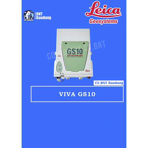
GPS Geodetik RTK GNSS Lieca GS10

The Leica Viva GS10 and GS25 high-precision receivers combine all features to provide peak performance, even under the most demanding conditions. Rest assured you are receiving the most accurate results when you count on the positioning reliability of the Viva GS10 and GS25.

Ensure today’s and tomorrow’s success with these outstanding GNSS receivers that offer upgrade functionality options to adapt with advancing satellite positioning systems. Regardless of the task at hand, enjoy the confidence that comes with a job well done using the Viva GS10 and GS25.

The Leica Viva GS10 and GS25 receivers also deliver with:

Engaging software
The Leica Viva GS10 and GS25 receivers come with the revolutionary Leica Captivate software, turning complex data into the most realistic and workable 3D models. With easy-to-use apps and familiar touch technology, all forms of measured and design data can be viewed in all dimensions. Captivate spans industries and applications with little more than a simple swipe, regardless of whether you work with GNSS, total stations or both.

Infinite possibilities
While Captivate captures and models data in the field, Leica Infinity software processes the information back in the office. A smooth data transfer ensures the project stays on track. Captivate and Infinity work in conjunction to join previous survey data and edit projects faster and more efficiently.

Customer care at a click
Through Active Customer Care, a global network of experienced professionals is only a click away to expertly guide you through any problem.

  • Eliminate delays with superior technical service
  • Finish jobs faster with excellent consultancy support
  • Avoid costly site revisits with online service to send and receive data directly from the field

Control your costs with a tailored Customer Care Package, giving you peace of mind you’re covered anywhere, anytime.

Powerful handheld devices
In a controller or a tablet, take your entire office on the go when you discover the power to overcome any environment from the palm of your hand.  The Leica CS20 controller and Leica CS35 tablet provide the ultimate in control and convenience with complete mobility. Touch screen technology allows for comfortable and quick data processing while a stunning 3D view transforms your Leica Viva GNSS experience.