Results for "theodolite"

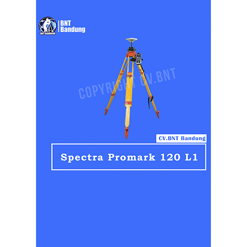
GPS Geodetik RTK GNSS Spectra 120 L1

Spesifikasi Dan Fitur Gps Geodetik Spectra Precision ProMark 120 L1 Gps Static

ProMark 120 L1 GPS (Harga untuk barang NON GLONASS)
The Spectra Precision ProMark 120 GNSS system is the most versatile post-processing solution, designed for easy and efficient land survey applications. Thanks to the embedded Ashtech Z-Blade technology as well as GPS and GLONASS signals tracking, ProMark 120 provides high-precision measurements even in very demanding or obstructed environments.

GPS Geodetik RTK GNSS Lieca GM 30

To make fast and informed decisions, monitoring professionals everywhere require actionable positioning data of critical natural and man-made structures. Exceeding GNSS signal needs today and tomorrow by supplying 555 GNSS channels, the Leica GM30 monitoring receiver is future-proof, reliably delivering the highest quality results 24/7.

With the support of all available and future GNSS signals, specialists are guaranteed timely and accurate information on the status of sensitive structures to detect and react to potential problems.

All-in-one GNSS monitoring receiver
The Leica GM30 is designed for continuous operations and diversity of monitoring scenarios. This receiver is packed with full feature on-board software including site monitor, Leica VADASE, data logging and FTP push.

With low energy consumption, simultaneous and multiple communications interfaces, and design to withstand the challenging environment conditions, this rugged receiver is ready for any challenge.

High-end GNSS technology
Exceeding GNSS signal needs today and tomorrow by supplying 555 GNSS channels, the Leica GM30 monitoring receiver is future-proof, reliably delivering the highest quality results 24/7. Detect and react to potential problems quicker with the support of all available and future GNSS signals delivering timely and accurate information on the status of sensitive structures.

With innovative SmartTrack+ technology, interference is no longer a threat. Maintain continuous GNSS multi-frequency operation, even in challenging radio frequency environments. Gain insight into the frequency power spectrum as it is seen by the receiver, including all desired, as well as undesired, signals. Easily identify and mitigate unintentional or intentional interference sources.

Versatile and customisable
The Leica GM30 is ready to be customised to cover any monitoring scenario from long-term static to dynamic high-frequency monitoring. This receiver is easily combined with a variety of external devices, and the Leica GM30 seamlessly connects with Leica Spider and Leica GeoMoS. In addition, the on-board data logging provides direct connection with Leica CrossCheck.

Leica VADASE
Leica VADASE (Velocity and Displacement Autonomous Solution Engine) provides an in-depth look into fast movements using unique processing algorithms. In real time, accurate high-rate velocity and displacement information of various activities and structures are provided to engineers and researchers for a complete, precise and reliable monitoring solution.

Leica VADASE delivers actionable information independent of any GNSS RTK correction service in real time. Displacement events are streamed out or recorded onboard a single stand-alone GNSS receiver, and the user can be notified by email. With this instant information, professionals receive a deeper understanding of how structural movements occur and can take necessary actions to mitigate damages and potentially save lives with:

  • Fully-autonomous, stand-alone receiver – no GNSS RTK correction services needed
  • Instant information on fast relative displacements up to 20 Hz delivered in real time
  • Integration into early warning systems

 

GPS Geodetik RTK GNSS Lieca Zeno GG04

Collecting high-accuracy geospatial data on your smartphone or tablet has never been easier.

Pair with all existing Leica Zeno handhelds and a wide range of Android, Apple or Windows® smart devices, to bring cutting-edge GNSS technology and industry-leading 555 channel tracking power to your hands.

The rugged, flexible and easy-to-use smart antenna utilises RTK technology and can now apply Precise Point Positioning (PPP). This makes high-accuracy data collection possible in real-time even in the most demanding of locations without the need for a mobile data connection.

With its compact, lightweight design and IP68 durability, you can work longer in all conditions – the world of high accuracy mapping comes to life at your fingertips.

Smart device independence

  • Use your existing smartphone or tablet
  • Available for Android, Apple and Windows®
  • Bluetooth® connection ensures cable free operation

Enhanced tracking performance

  • 555 channels support an increased number of satellites
  • State-of-the-art GNSS technology
  • Ready for future GNSS developments

Precise point positioning (PPP)

  • Achieve high accuracy data collection without a mobile data connection
  • Available anywhere in the world, anytime
  • Removes reliance on post processing

Extensive software support

  • Use with your favourite data collection apps and software
  • No development efforts required
  • Provides NMEA messages output on different Bluetooth® ports to allow reviewing and storing of GNSS metadata information

Built to last

  • IP68 protection ensures water and dustproofing
  • Continuous performance in all environments
  • All day battery life


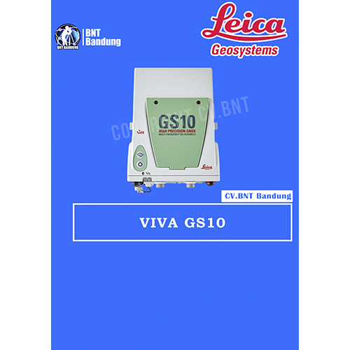
GPS Geodetik RTK GNSS Lieca GS10

The Leica Viva GS10 and GS25 high-precision receivers combine all features to provide peak performance, even under the most demanding conditions. Rest assured you are receiving the most accurate results when you count on the positioning reliability of the Viva GS10 and GS25.

Ensure today’s and tomorrow’s success with these outstanding GNSS receivers that offer upgrade functionality options to adapt with advancing satellite positioning systems. Regardless of the task at hand, enjoy the confidence that comes with a job well done using the Viva GS10 and GS25.

The Leica Viva GS10 and GS25 receivers also deliver with:

Engaging software
The Leica Viva GS10 and GS25 receivers come with the revolutionary Leica Captivate software, turning complex data into the most realistic and workable 3D models. With easy-to-use apps and familiar touch technology, all forms of measured and design data can be viewed in all dimensions. Captivate spans industries and applications with little more than a simple swipe, regardless of whether you work with GNSS, total stations or both.

Infinite possibilities
While Captivate captures and models data in the field, Leica Infinity software processes the information back in the office. A smooth data transfer ensures the project stays on track. Captivate and Infinity work in conjunction to join previous survey data and edit projects faster and more efficiently.

Customer care at a click
Through Active Customer Care, a global network of experienced professionals is only a click away to expertly guide you through any problem.

  • Eliminate delays with superior technical service
  • Finish jobs faster with excellent consultancy support
  • Avoid costly site revisits with online service to send and receive data directly from the field

Control your costs with a tailored Customer Care Package, giving you peace of mind you’re covered anywhere, anytime.

Powerful handheld devices
In a controller or a tablet, take your entire office on the go when you discover the power to overcome any environment from the palm of your hand.  The Leica CS20 controller and Leica CS35 tablet provide the ultimate in control and convenience with complete mobility. Touch screen technology allows for comfortable and quick data processing while a stunning 3D view transforms your Leica Viva GNSS experience.


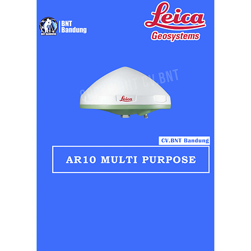
GPS Geodetik RTK GNSS Lieca AR10

An all new antenna design, together with a large ground plane and integrated radome, ensures that the AR10 provides exceptional signal tracking, phase centre accuracy and multipath suppression.

Integrated radome
Thanks to the integrated radome, the Leica AR10 prevents build up of snow which could otherwise degrade signal quality.The non-spherical radome is designed for optimal signal quality and has the added benefit of discouraging birds from perching on the antenna, a common source of signal attenuation with rounded radomes.

The aerodynamic shape of the antenna reduces wind loading and together with the light weight ensures that the Leica AR10 can be used with a variety of antenna masts or as a field or campaign base on a tripod. Constructed using a robust and UV resistant enclosure the Leica AR10 is made to withstand extreme temperature, humidity, dust, salt, solar radiation, pollution, shock and vibration.

Superior performance
Designed from the ground up for wideband tracking, the new wideband antenna technology introduced in the Leica AR10 provides superior low elevation tracking, multipath suppression and antenna phase centre accuracy across all frequency bands. An all new low noise amplifier (LNA) is used to provide exceptional low measurement noise for superior measurement quality.

The new LNA technology also has excellent out of band rejection, helping to significantly reduce potential interference due to jamming. The Leica AR10 is suitable for use with antenna cable lengths up to 70 m without the need for an in-line amplifier.

Future proof
With emerging satellite systems close on the horizon, such as the European Galileo system and the Chinese Compass (Beidou 2) system, it is more important than ever before to have a true GNSS antenna. In line with Leica Geosystems “future proof” philosophy.

The Leica AR10 has been designed for all existing and currently planned signals of the GPS, GLONASS, Galileo and Compass global navigation satellite systems and the SBAS, QZSS, Gagan, OmniSTAR and other L-band augmentation systems.


GPS Geodetik RTK GNSS Horizon Cronos C3

HORIZON GPS GEODETIK KRONOS 300

The Kronos 300 is a GNSS receiver that allows you to do more, a HORIZON GNSS product which continues with the tradition of performance excellence shown by the Kronos 200 GNSS system. It now features a more robust and rugged housing, within which resides a faster and more powerful BD970 boardbuilt on the proven Maxwell 6 technology.

Like the Kronos 200, the Kronos 300 also features an in-built GSM/GPRS module, as well as an in-built UHF transmitter module for a complete communication interface. The UHF modulehas been upgraded to a power-switchable type, which would allow atransmission range of beyond 8 km independently.

Spesifikasi Horizon Kronos 300:
• 220 Channel
• GPS GLONNAS QZSS
• GALILEO SBAS Beidou
• L1 L2 L5
• Statik 3mm
• RTK 8mm
• Outsanding waterproof IP67