Results for "theodolite"

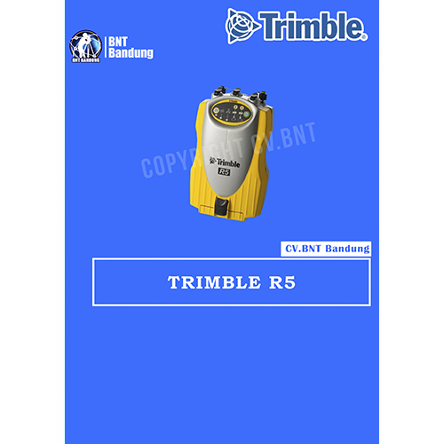
GPS Geodetik RTK GNSS Trimble R5

Detail Produk dan Spesifikasi GPS Geodetic TRIMBLE R5

Jual Trimble R5 GPS Geodetic, yang digunakan untuk menentukan batas daerah yang berupa perairan, yakni dengan membuat pilar di kedua daratan masing-masing daerah (disebut titik pangkal perairan). Selanjutnya dari titk-titik pangkal tersebut, dengan metode penentuan batas yang tertentu dapat ditentukan batas antara kedua daerah.

  • Sangat fleksibel untuk dibawa kemana – mana.
  • Dapat dihubungkan ke antenna eksternal dalam mobil anda.
  • Multi channel dan multi frekuensi penerima.
  • Pemilihan 3 pengontrol yang berbeda TSC2, TSC3 dan Trimble CU.
  • Mempunyai fitur yang canggih teknologi Trimble GNSS.
  • Kinerja tinggi mesin RTK yang memberikan presisi dan akurasi.
  • GPS L2C disertakan dengan tambahan GLONASS.

Berikut spesifikasi dari Trimble R5 GPS Geodetic

SPESIFIKASI FISIK
Ukuran (W x H x L) 13.5 x  8.5 x 24 cm

5.3 x 3.4 x 9.5 in

Berat (dengan 2 baterai) 1.5 kg (3.1 lb)
Waktu penggunaan (dengan dua baterai  2.4 Ah) pada 20°C RTK dengan radio internal 6 – 8 jam

Tempat proses > 10 jam

Sumber daya 10 .5 V DC – 28 V DC dengan perlindungan tegangan lebih
Suhu penggunaan –40°C – +65°C (–40°F – +149°F)
Suhu penyimpanan –40°C – +80°C (–40°F – +176°F)
Kelembaban 100% kondensasi
Anti air dan debu IP67 (tahan debu), dilindungi dari sementara

perendaman dengan kedalaman 1 m (3 .28 ft)

Pemakaian daya 4 .0 W hanya untuk penerimaan (track dan logging)

4 .4 W termasuk radio internal (tidak menerima CMR)

5 .9 W (track SV’s, logging pada 1 Hz, external antenna eksternal dan pada mode RTK)

Daya output 6 .5 V – 20 V (Port 1) maksimum 50 mA

10 .5 V – 28 V (Port 3) maksimum 0, 5 A

Penyimpanan data pada 256MB flash memori pada jarak waktu 15 detik 4600 jam, GPS + GLONASS dengan 13 SV

8900 jam, hanya GPS dengan 8 SV

SPESIFIKASI PENGATURAN POSISI
Perubahan GPS posisi 1 0 .25 m + 1 ppm RMS (horizontal)

0 .50 m + 1 ppm RMS (vertikal)

<5 m 3DRMS (WAAS dengan perubahan akurasi)

GPS survey statis dan faststatic 1 3 mm + 0 .1 ppm RMS (horizontal)

3.5 mm + 0 .4 ppm RMS (vertikal)

Survey kinematik 1 10 mm + 1 ppm RMS (horizontal)

20 mm + 1 ppm RMS (vertikal)


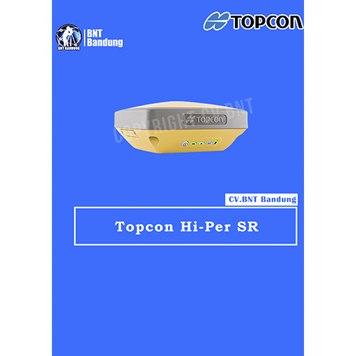
GPS Geodetik RTK GNSS Topcon Hiper SR

Topcon HiPer SR GNSS Receiver Superior multi-constellation Vanguard GNSS chipset, Integrated multi-channel LongLink communication technology, designed specifically for small to medium size sites

Providing leading edge technology in a smart, rugged design, the new HiPer SR with optional Cellular configuration adds possibilities to your job site. With an integrated cellular modem, the new HiPer SR becomes an extended GNSS range site receiver and can be used in a variety of setup including MAGNET Relay, Network, and LongLinkTM. While bringing flexibility, the HiPer SR Cellular configuration still provides superior performance at an affordable price.

Topcon HiPer SR GNSS solution is ideal for interference-free, short-range, wireless communication between base and rover. With an optional, internal, dual-SIM cellular modem the HiPer SR can also be used as a MAGNET Relay mobile base, adding flexibility to your portfolio for your various project scenarios

  • Capable of tracking GPS and GLONASS constellations
  • Universal Tracking Channels capable of all-in-view tracking
  • Hybrid Positioning ready
  • Signal scrubbing Fence Antenna® to provide ultimate signal lock
  • Highest accuracy positioning for RTK, network, and more

HiPer SR Specifications

GNSS Tracking

  • Number of Channels: 226-Channel Vanguard Technology with Universal Tracking Channels
  • Signals Tracked: GPS, GLONASS, SBAS, QZSS
  • Antenna Type: Fence Antenna

Accuracy

  • Static/Fast Static: H: 3.0 mm + 0.4 ppm, V: 5.0 mm + 0.6 ppm
  • Precision Static: H: 3.0 mm + 0.1 ppm, V: 3.5 mm + 0.4 ppm
  • RTK (L1+L2): H: 10 mm + 0.8 ppm, V: 15 mm + 1.0 ppm
  • DGPS: H: 0.4 m, V: 0.6 m
  • SBAS: H: 1.0 m, V: 1.5 m

Communications

  • I/O Communications: Bluetooth®, Serial, USB
  • Cellular: Integrated HSPA+/CDMA

Memory

  • Memory: 2GB internal
  • Real Time Data Output: TPS, RTCM SC104 v2.x, 3.x and MSM, CMR/CMR+
  • ASCII output: NMEA 0183 version 2.x, 3.x and 4.x

Physical and Environmental

  • Dimensions: W: 5.9” (150 mm), D: 5.9” (150 mm), H: 2.5” (64 mm)
  • Weight: 1.87 lbs. (850g) – Basic, 2.04 lbs. (925g) – Cellular
  • Operating Temperature*: -20ºC to 65ºC, -40ºC to 65ºC
  • Storage Temperature: -40ºC to 70ºC

Certifications and Standards

  • Dust/Water Protection: IP67

Power and Electrical

  • External Power Connector: Yes

Performance

  • Operation Time: Up to 20 hours


Gratis Pelatihan

Note:
*Harga Dapat Berubah Sewaktu – waktu tanpa pemberitahuan terlebih dahulu.
*Mohon tanya ketersediaan barang terlebih dahulu.

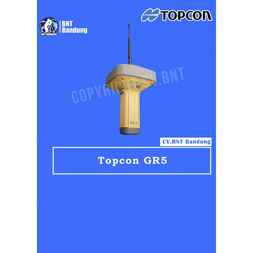
GPS Geodetik RTK GNSS Topcon Hiper GR5

The latest GR-5 features the multi-constellation 226-Channel Vanguard GNSS chip with Universal Tracking Channel Technology. The GR-5 also includes Topcon’s patented Fence Antenna Technology design which offers a compact and lightweight antenna that covers the entire GNSS frequency band for unmatched performance. With Vanguard, Fence Antenna, and Topcon’s advanced acquisition algorithms, the GR-5 receiver delivers the most robust GNSS tracking performance available.

terbaru menampilkan chip GNSS Vanguard 226-Channel multi-konstelasi dengan Teknologi Saluran Pelacakan Universal. GR-5 juga mencakup desain Teknologi Antena Pagar yang dipatenkan Topcon yang menawarkan antena yang ringkas dan ringan yang mencakup seluruh pita frekuensi GNSS untuk kinerja yang tak tertandingi. Dengan Vanguard, Fence Antenna, dan algoritma akuisisi canggih

  • 226-Channel Vanguard Technology™ dengan Saluran Pelacakan Universal
  • Teknologi Fence Antenna™ untuk pengoptimalan sinyal
  • Beberapa opsi komunikasi untuk keserbagunaan lokasi kerja
  • Dukungan penyimpanan SDHC 32 GB
  • Baterai ganda yang dapat diganti

GPS Geodetik Topcon GR5 menampilkan chip Vanguard GNSS 226 saluran multi-konstelasi dengan Teknologi Saluran Pelacakan Universal. Teknologi yang dipatenkan ini menggunakan metode pelacakan yang fleksibel dan dinamis untuk secara otomatis memilih dan melacak sinyal satelit yang tersedia yang memungkinkan pengguna Topcon menerima jumlah sinyal dan pengukuran maksimum pada waktu tertentu.

GPS Geodetik Topcon GR5 tidak hanya mampu menerima sinyal dari konstelasi GPS dan GLONASS yang beroperasi penuh, tetapi juga memiliki kemampuan untuk mendukung semua sinyal yang direncanakan dari sistem yang sedang berkembang seperti Galileo, Beidou (BDS) dan QZSS. Dengan konstelasi satelit saat ini dan yang sedang berkembang, Teknologi Saluran Pelacakan Universal mengoptimalkan pelacakan sinyal GNSS untuk menjamin geometri dan ketersediaan satelit maksimum.

Desain Antena Pagar Topcon yang dipatenkan menghadirkan penerimaan sinyal yang superior dan penolakan multipath tingkat lanjut di lingkungan yang sulit. Teknologi ini memberikan pelacakan sinyal yang lebih kuat dan bersih yang berarti hasil yang tak tertandingi.

Dengan Teknologi Vanguard, Saluran Pelacakan Universal, dan Antena Pagar, GPS Geodetik Topcon GR 5 dirancang untuk memberikan kinerja lapangan terbaik bahkan di lingkungan yang menantang sambil mempertahankan akurasi, kecepatan inisialisasi, dan keandalan yang tak tertandingi untuk solusi RTK.

Selain teknologi canggih, desain mekanis GPS Geodetik Topcon GR5 membuatnya sangat andal, ergonomis, dan tahan lama. Dijamin kokoh, GPS Geodetik Topcon GR5 adalah receiver GNSS terbaik yang tersedia di pasaran.


Note:
*Harga Dapat Berubah Sewaktu – waktu tanpa pemberitahuan terlebih dahulu.
*Mohon tanya ketersediaan barang terlebih dahulu.

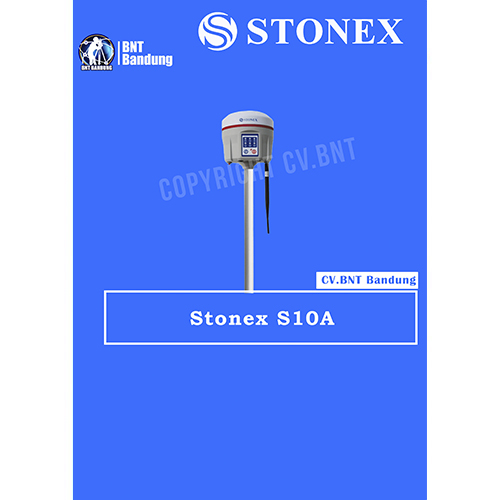
GPS Geodetik RTK GNSS Stonex S10

Spesifikasi Dan Fitur Gps Geodetik Stonex S10 GNSS Receiver RTK

Deskripsi:

The New Generation GNSS Receiver
Stonex S10, the most advanced integrated GNSS Receiver ever appeared on the geomatic scene, leads to a new generation of smart and open GPS, where the User has the ability to install customized applications directly on the receiver.

The advanced features of Stonesx S10, such as automatic leveling with electronic bubble, make surveying much faster and accurate.

The sophisticated internal structure design guarantees a compact housing: GNSS antenna, GPS board, power board, RX/TX radio, smart battery, 3.5G module, BT module and Wi-Fi module all take place in a well organized space, optimizing performances and power consumption.

Stonex S10 is based on CORTEX-A8 platform with on board LINUX smart system combined with an excellent networking system. With the provision of a special SDK package it is possible to develop and install special applications that run inside S10 ecosystem, enabling an unlimited range of advanced applications.

Fitur:

  • MULTI CONSTELLATION Stonex S10 with its 220 channels, provides an excellent on board real time navigation solution with high accuracy. All GNSS signals (GPS, GLONASS, BEIDOU and GALILEO) are included, no additional cost.
  • WEB UI CONTROL To initialize, manage, monitor the settings of the receiver and to download data using portable or PC, smartphone or tablet.
  • TILT CENTERING Its possible to measure points with inclination up to 30. The tilt compensator installed inside can automatically correct the coordinates of the points collected in accordance with the tilt angle and tilt direction of the range pole.
  • TWO INTELLIGENT BATTERIES Stonex S10 is delivered with two high capacity smart batteries. The power level can be checked from the controller and directly from a simple led bar on the battery by the simple press of a button.
  • RUGGED DESIGN IP67 PROTECTION IP67 certification, combined with a high shock resistance guarantee the maximum strength and the best water and dust tight even in harsh environments.


GPS Geodetik RTK GNSS Spectra SP80 

The SP80 is a new generation GNSS receiver. SP80 uses the unique Z-Blade technology to track and process all available GNSS signals, to provide the most reliable measurements and the highest possible accuracies in challenging environments.

It also offers the best communications and connectivity capabilities available today including SMS and email alerts and anti-theft protection. The ergonomic design and unlimited operating time make the SP80 an extremely versatile and complete solution.

The SP80 GNSS receiver is a powerful, rugged and easy-to-use system designed for everyday surveyors. The SP80’s Z-Blade GNSS-centric technology delivers fast and reliable GNSS positioning utilizing all available GNSS signals to produce the optimal solution even in challenging environments. GPS-only, GLONASS-only or BeiDou-only positioning modes are available when necessary.

Unique communication technologies keep the surveyor connected. Web UI access via WiFi and SMSs can be used to monitor and configure the receiver. RTK bridge can save you money as network corrections can be relayed via radio to any rover in the survey job area.

Anti-theft technology protects your investment by sending emails and SMSs to alert users as well as making the receiver unusable if the SP80 base has been moved.