Results for "GPS RTK"

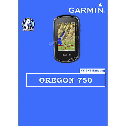
Gps Garmin Oregon 750

SPESIFICATION GPSMAP GARMIN OREGON 750

Perangkat GPS/GlONASS yang Tangguh dengan Wi-Fi bawaan , Kamera dan banyak lagi

  • Penerima sinyal GPS dan Satelit GLONASS dengan kepekaan tinggi untuk performa yang lebih baik di lingkungan yang menantang dibanding dengan GPS saja.
  • Antena yang di desain ulang untuk performa dan penerimaan yang lebih baik, kompas 3-axis dengan sensor akselerometer, barometer dan altimeter.
  • Tampilan layar sentuh yang dapat dibaca di bawah sinar matahari dengan orientasi ganda  berukuran 3″ ( Lanskap ataupun potrait )
  • Koneksi Nirkabel yang diperluas ( kapabilitas Wi-Fi , Bluetooth® , ANT+®) ; termasuk notifikasi¹ cerdas dan pengunggahan otomatis ke komunitas online Garmin Connect™  dan dukungan Active Weather dan Geocaching Live
  • Kamera auto-fokus 8MP ; foto dengan penandaan geografis otomatis
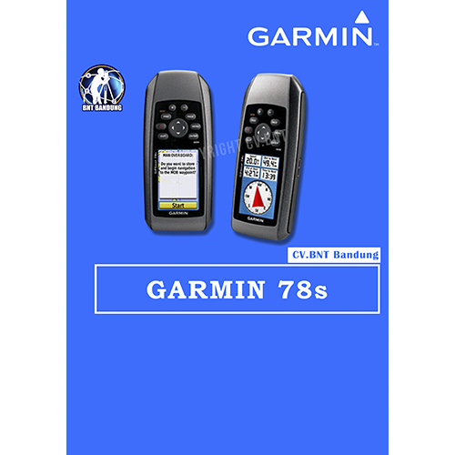
Gps Garmin 78s

SPESIFICATION GPSMAP GARMIN 78s

    • Automatic routing (turn by turn routing on roads):yes (with optional mapping for detailed roads)
    • Electronic compass:yes (tilt-compensated, 3-axis)
    • Touchscreen:no
    • Barometric altimeter:yes
    • Camera:no
    • Geocaching-friendly:yes (paperless)
    • Custom maps compatible:yes
    • Photo navigation (navigate to geotagged photos):yes
    • Outdoor GPS games:no
    • Hunt/fish calendar:yes
    • Sun and moon information:yes
    • Tide tables:yes
    • Area calculation:yes
    • Custom POIs (ability to add additional points of interest):
    • Unit-to-unit transfer (shares data wirelessly with similar units):yes
    • Picture viewer:no
    • Garmin Connectâ„¢ compatible (online community where you analyze, categorize and share data):yes

SPESIFICATION 

  • Akurasi : 3 – 5 meter
  • Resolusi layar, WxH: 160 x 240 piksel
  • Baterai alkaline
  • basemap
  • built in memory 1.7GB
  • titik : 7.000 point

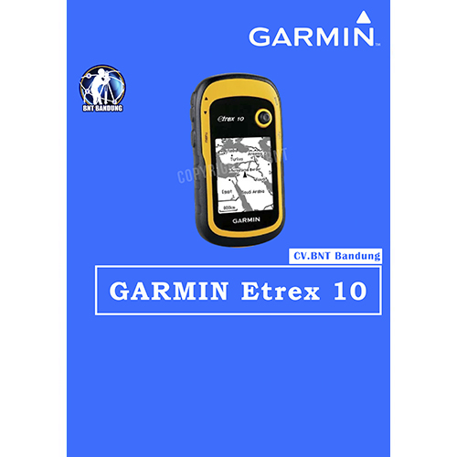
Gps Garmin Etrex 10

SPESIFICATION GPSMAP GARMIN ETREX 10

  • Rugged Handheld GPS with Enhanced Capabilities
  • Worldwide basemap
  • 2.2″ monochrome display, easy to read in any light
  • GPS and GLONASS satellites for faster positioning
  • Paperless geocaching
  • 25-hour battery life with 2 AA batteries

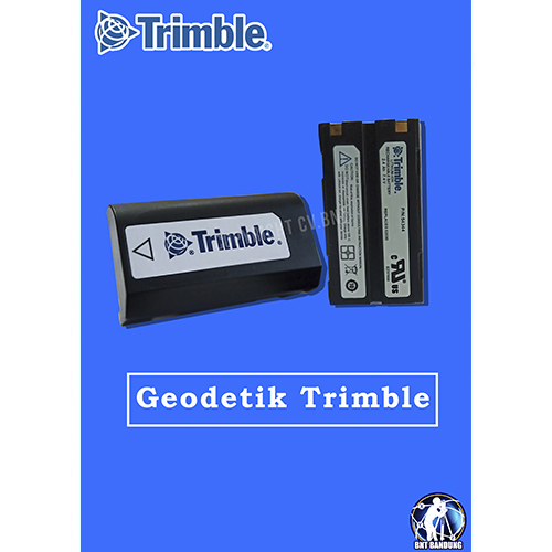
SPESIFICATION BATRE GPS GEODETIK TRIMBLE

1. The battery for Trimble Series R8/R7/R6/R8GNSS/GPS;
2. Type:Voltage and capacity: 7.4V/2400mAh;


HARGA BELUM TERMASUK PPN 10%
HARGA SEWAKTU-WAKTU DAPAT BERUBAH

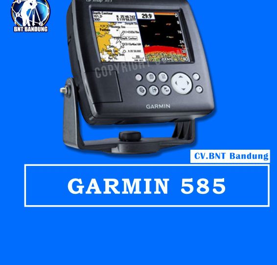
Physical & Performance:

  • Unit dimensions, WxHxD:    5.9″ x 6.4″ x 2.9″ (15.0 x 16.3 x 7.4 cm)
  • Display size, WxH:    5”, 120.7×75.8mm
  • Display resolution, WxH:    480×272 pixels
  • Display type:    WQVGA
  • Weight:    390g
  • Waterproof:    yes (IPX7)

Maps & Memory:

  • Basemap:    yes
  • Preloaded maps:    no
  • Ability to add maps:    yes
  • Accepts data cards:    SD card slot
  • Waypoints/favorites/locations:    6000
  • Routes:    150 tracks/250 points

Features:

  • CANet® compatible:    no
  • Supports AIS (tracks target ships’ position):    yes
  • Supports DSC (displays position data from DSC capable VHF radio):    yes
  • Audible alarms:    yes
  • Tide tables:    yes
  • Sun and moon information:    yes
  • 3-D map view:    no
  • Dual-frequency sonar capable:    yes
  • Dual-beam sonar capable :    no
  • Split-screen zoom:    yes
  • Split-screen sonar/gps:    yes
  • Ultrascroll™ (displays fish targets at higher boat speeds):    yes
  • See-thru® technology (exposes fish hidden in cover):    yes
  • Fish Symbol ID (helps identify fish targets):    yes
  • AutoGain Technology (minimizes clutter, maximizes targets):    yes
  • Whiteline (indicates hard or soft bottom):    yes
  • Adjustable depth line (measures depth of underwater objects):    yes
  • A-scope (real time display of fish passing through transducer beam):    yes
  • Bottom lock (shows return from the bottom up):    yes
  • Water temperature log and graph:    yes
  • Water temperature sensor included:    yes (need to equipt with correct tranducer)

Sonar:

  • Frequency:    50/200 kHz
  • Transmit power:    500W(RMS), 4,000W(peak to peak)
  • Voltage range:    10-36 VDC
  • Maximum depth*:    1,500ft
  • Cone angle:    20 degrees

*Depth capacity is dependent on water salinity, bottom type, and other water conditions.

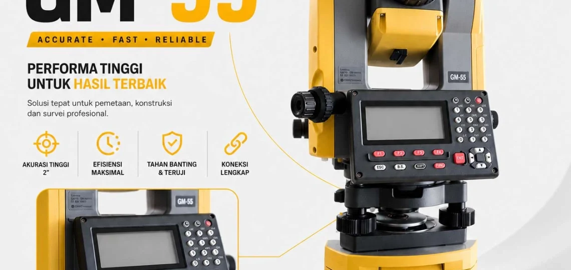
Jual Total Station Topcon GM-55 Harga Terbaik

Apabila Anda sedang mencari Jual Total Station Topcon GM-55 harga terbaik, CV.BNT merupakan pilihan yang tepat. Kami melayani penjualan alat survei original dengan harga kompetitif, garansi resmi, layanan servis dan kalibrasi, serta dukungan teknis yang berpengalaman.

Selain penjualan Total Station, CV.BNT juga melayani jual GPS RTK murah di CV.BNT, penyediaan GPS RTK GNSS, layanan sewa alat survey, kalibrasi, servis, pelatihan penggunaan alat, hingga konsultasi teknis untuk berbagai kebutuhan proyek di seluruh Indonesia.

Hubungi CV.BNT sekarang untuk mendapatkan penawaran harga terbaik, konsultasi gratis, dan solusi alat survei profesional yang sesuai dengan kebutuhan proyek Anda.