
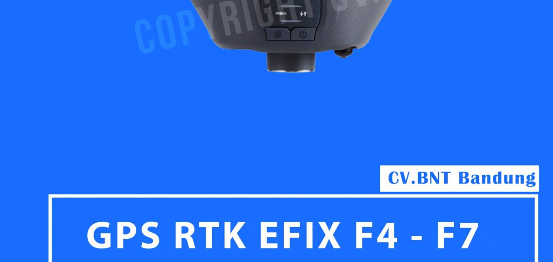
Results for "GPS RTK"

Spesifikasi  RTK EFIX F4-F7

  • Jumlah saluran 824 saluran
    GPS L1, L2, L5
    GLONASS L1, L2
    Galileo E1, E5a, ESb
    BeiDou B1, B2, B3
    SBAS L1
    QZSS L1, L2, L5
  • Ketepatan
    Pengukuran dinamis waktu nyata (RTK)
    Horizontal: 8 mm + 1 ppm RMS
    Vertikal: 15 mm + 1 ppm RMS
    Waktu inisialisasi: <10 detik
    Keakuratan: > 99,9%
    Pengukuran dinamis pasca-pemrosesan (PPK)
    Horizontal: 3 mm + 1 ppm RMS
    Vertikal: 5 mm + 1 ppm RMS
    Pengukuran statis
    Horizontal: 2.5 mm + 0.5 ppm RMS
    Vertikal: 5 mm + 0,5 ppm RMS
    Ukur DGPS
    Horizontal: 0,4 m RMS
    Vertikal: RMS 0,8 m
    Pengukuran titik tunggal
    Horizontal: 1,5 m RMS
    Vertikal: 3,0 m RMS
    Tingkat pemosisian
    1Hz, 5Hz dan 10Hz
    Perbaiki waktu
    Mulai pemosisian: <45 detik
    Memperbaiki waktu restart: <10s
    Awalnya menerima sinyal: <1s
  • Kompensasi kemiringan RTK
    Tidak
  • Perangkat keras
    Dimensi (LxWxH)
    160mmx158mmx96mm (6,3 incix6,2 incix 3,8 inci)
  • Bobot
    1,48 kg (3,26 pon)
  • Lingkungan Hidup
    Pengoperasian: -40 ° C hingga + 65 ° C (-40 ° F sampai + 149 ° F)
    Penyimpanan: -40 ° C hingga + 85 ° C (-40 ° F sampai + 185 ° F)
    Kelembaban 100% kondensasi
    Tahan kelembaban IP67 tahan air dan tahan debu, tahan air hingga kedalaman 1m untuk jangka waktu tertentu Syok Jarak 2m ke lantai beton Sensor kemiringan
    IMU tidak membutuhkan kalibrasi untuk kompensasi kemiringan. Kebal terhadap gangguan magnetis
    Panel depan 4 LED Status 2 Tombol
    Komunikasi dan perekaman data | WIFI 802.11 b / g / n, mode titik akses
    Bluetooth V4.1 Pelabuhan 1 x port USB Type-C (pengunduhan data,
    pembaruan firmware pengisi daya)
    1 x port antena UHF (TNC)
    Radio UHF Standar Internal Rx: 430- 470 MHz
    Protokol: CHC, Transparan, TT450
    Kecepatan tautan: 9600 bps / 19200 bps
  • Format data
    Masukan dan keluaran CMR
    RTCM 2.x, RTCM 3.x masukan dan keluaran
    Keluaran NMEA 01 83
    HCN, HRC dan RINEX Static format
    Klien NTRIP (di jaringan PDA)
  • Penghematan data
    Memori kecepatan tinggi 8 GB
  • Listrik
    Konsumsi energi
    3,8 W (tergantung pengaturan pengguna)
    Kapasitas baterai Li-ion
    Baterai dibangun di mesin 9600 mAh
  • Waktu operasi
    RTK Rover: 12 jam
    Statis: hingga 15 jam


Note:
*Harga Dapat Berubah Sewaktu – waktu tanpa pemberitahuan terlebih dahulu.
*Mohon tanya ketersediaan barang terlebih dahulu.

GPS RTK GNSS Trimble R10

Collect more accurate data faster and easier – no matter what the job or the environment, with the Trimble® R10 GNSS System. Built with powerful technologies integrated into a sleek design, this system provides surveyors with a powerful way to increase data collection productivity in every job, every day.
  • Powerful 672-channel solution with Trimble 360 technology delivers the most advanced satellite tracking
  • Improved protection against sources of interference and spoofed signals
  • Connect to Android or iOS mobile devices running supported apps via Bluetooth®
  • Trimble HD-GNSS processing engine enables surveyors to measure points more quickly
  • Trimble SurePoint™ compensates for pole tilt. Conveniently measure points that were otherwise inaccessible with complete quality assurance
  • Trimble CenterPoint® RTX delivers GNSS corrections via satellite or internet connection anywhere in the world with unprecedented speed and accuracy for a PPP solution
  • Trimble xFill® ensures less downtime in the field, with continuous RTK coverage during connection outages from an RTK base station or VRS network
  • Ergonomic design for easier and more comfortable handling
  • Integrates seamlessly with the Trimble SX10 scanning total station and S-Series total station positioning sensors
  • Pair with Trimble Access™ and the TSC7, TSC3, Slate or Trimble CU controller for the most powerful land surveying equipment solution on the market

Pure, uninterrupted surveying

  • With a Trimble CenterPoint RTX subscription, enhanced Trimble xFill functionality allows surveyors to continue collecting data with centimeter accuracy indefinitely after connection is lost with their base station or VRS network.
  • Without a Trimble CenterPoint RTX subscription, xFill maintains RTK level accuracy for up to five minutes during interruptions in the primary terrestrial correction stream. xFill functionality is built into every Trimble R10 GNSS system.

Collect more accurate data faster and easier

  • Survey inaccessible points, reduce occupation time and record faster and safer measurements than ever before.
  • Built-in firmware gives automatic compensation for up to 15 degrees of pole tilt.

Trimble software designed for surveyors

  • Bring the power and speed of the Trimble R10 system together with trusted Trimble land surveying software solutions, including Trimble Access and Trimble Business Center.
  • Trimble Access field software provides specialized and customized workflows to make surveying tasks quicker and easier while enabling teams to communicate vital information between field and office in real time. Back in the office, users can seamlessly process data with Trimble Business Center software.


Note:
*Harga Dapat Berubah Sewaktu – waktu tanpa pemberitahuan terlebih dahulu.
*Mohon tanya ketersediaan barang terlebih dahulu.


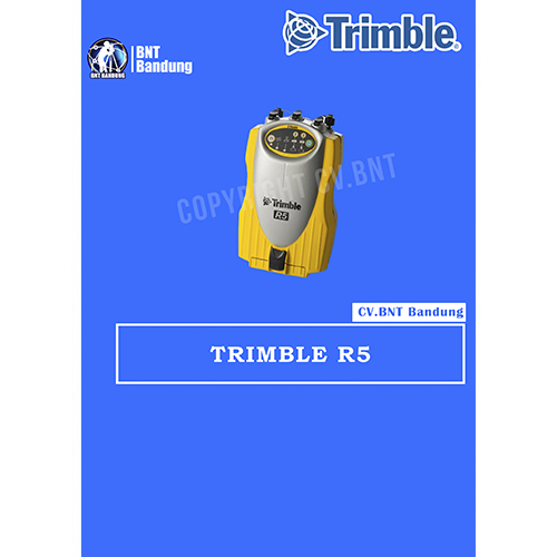
GPS Geodetik RTK GNSS Trimble R5

Detail Produk dan Spesifikasi GPS Geodetic TRIMBLE R5

Jual Trimble R5 GPS Geodetic, yang digunakan untuk menentukan batas daerah yang berupa perairan, yakni dengan membuat pilar di kedua daratan masing-masing daerah (disebut titik pangkal perairan). Selanjutnya dari titk-titik pangkal tersebut, dengan metode penentuan batas yang tertentu dapat ditentukan batas antara kedua daerah.

  • Sangat fleksibel untuk dibawa kemana – mana.
  • Dapat dihubungkan ke antenna eksternal dalam mobil anda.
  • Multi channel dan multi frekuensi penerima.
  • Pemilihan 3 pengontrol yang berbeda TSC2, TSC3 dan Trimble CU.
  • Mempunyai fitur yang canggih teknologi Trimble GNSS.
  • Kinerja tinggi mesin RTK yang memberikan presisi dan akurasi.
  • GPS L2C disertakan dengan tambahan GLONASS.

Berikut spesifikasi dari Trimble R5 GPS Geodetic

SPESIFIKASI FISIK
Ukuran (W x H x L) 13.5 x  8.5 x 24 cm

5.3 x 3.4 x 9.5 in

Berat (dengan 2 baterai) 1.5 kg (3.1 lb)
Waktu penggunaan (dengan dua baterai  2.4 Ah) pada 20°C RTK dengan radio internal 6 – 8 jam

Tempat proses > 10 jam

Sumber daya 10 .5 V DC – 28 V DC dengan perlindungan tegangan lebih
Suhu penggunaan –40°C – +65°C (–40°F – +149°F)
Suhu penyimpanan –40°C – +80°C (–40°F – +176°F)
Kelembaban 100% kondensasi
Anti air dan debu IP67 (tahan debu), dilindungi dari sementara

perendaman dengan kedalaman 1 m (3 .28 ft)

Pemakaian daya 4 .0 W hanya untuk penerimaan (track dan logging)

4 .4 W termasuk radio internal (tidak menerima CMR)

5 .9 W (track SV’s, logging pada 1 Hz, external antenna eksternal dan pada mode RTK)

Daya output 6 .5 V – 20 V (Port 1) maksimum 50 mA

10 .5 V – 28 V (Port 3) maksimum 0, 5 A

Penyimpanan data pada 256MB flash memori pada jarak waktu 15 detik 4600 jam, GPS + GLONASS dengan 13 SV

8900 jam, hanya GPS dengan 8 SV

SPESIFIKASI PENGATURAN POSISI
Perubahan GPS posisi 1 0 .25 m + 1 ppm RMS (horizontal)

0 .50 m + 1 ppm RMS (vertikal)

<5 m 3DRMS (WAAS dengan perubahan akurasi)

GPS survey statis dan faststatic 1 3 mm + 0 .1 ppm RMS (horizontal)

3.5 mm + 0 .4 ppm RMS (vertikal)

Survey kinematik 1 10 mm + 1 ppm RMS (horizontal)

20 mm + 1 ppm RMS (vertikal)


GPS RTK Topcon Hiper V

Compact, cable-free solution with Vanguard Technology for all GNSS positioning applications.
In a continued commitment to improving the productivity of positioning professionals, Topcon enhances the HiPer family of products by adding Vanguard Technology to the HiPer V. In the early 2000’s Topcon revolutionized GNSS receivers by integrating the design to be compact and light weight. Topcon continues the revolution with Vanguard technology.

Features:

  • Vanguard Technology
  • 226 GNSS Channels
  • Rugged, Magnesium Alloy Construction
  • Integrated RTK and Static Receiver
  • Fence Antenna Advanced Performance

Topcon raises the standard once again by adding Vanguard Technology’s 226 channels and fence antenna into a versatile, configurable receiver, HiPer V. The additional channels and precision antenna element make RTK positioning faster and more productive than any other receiver on the market.

  1. Number of channels and tracked signals vary according to receiver configurations.
  2. RMS Values. Accuracy depends on the number of satellites used, obstructions, satellite geometry (DOP), occupation time, multipath effects, atmospheric conditions, baseline length, survey procedures and data quality.
  3. 10 Hz standard. Higher rates available as options.

Top features include:

  • Universal tracking technology for all satellites and constellations (GPS, GLONASS, Galileo, Beidou, IRNSS, QZSS, SBAS) covering all modernized signals
  • Field tested, field ready IP67 design
  • Compact form factor ideal for Millimeter GPS and Hybrid Positioning
  • Revolutionary 9-axis IMU and ultra-compact 3-axis eCompass
  • Integrated 400 MHz UHF Tx/Rx Radio Modem
  • Integrated License free 900 MHz Radio Modem, FH915 protocol


Note:
*Harga Dapat Berubah Sewaktu – waktu tanpa pemberitahuan terlebih dahulu.
*Mohon tanya ketersediaan barang terlebih dahulu.
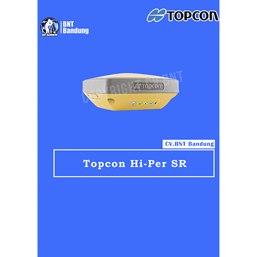
GPS Geodetik RTK GNSS Topcon Hiper SR

Topcon HiPer SR GNSS Receiver Superior multi-constellation Vanguard GNSS chipset, Integrated multi-channel LongLink communication technology, designed specifically for small to medium size sites

Providing leading edge technology in a smart, rugged design, the new HiPer SR with optional Cellular configuration adds possibilities to your job site. With an integrated cellular modem, the new HiPer SR becomes an extended GNSS range site receiver and can be used in a variety of setup including MAGNET Relay, Network, and LongLinkTM. While bringing flexibility, the HiPer SR Cellular configuration still provides superior performance at an affordable price.

Topcon HiPer SR GNSS solution is ideal for interference-free, short-range, wireless communication between base and rover. With an optional, internal, dual-SIM cellular modem the HiPer SR can also be used as a MAGNET Relay mobile base, adding flexibility to your portfolio for your various project scenarios

  • Capable of tracking GPS and GLONASS constellations
  • Universal Tracking Channels capable of all-in-view tracking
  • Hybrid Positioning ready
  • Signal scrubbing Fence Antenna® to provide ultimate signal lock
  • Highest accuracy positioning for RTK, network, and more

HiPer SR Specifications

GNSS Tracking

  • Number of Channels: 226-Channel Vanguard Technology with Universal Tracking Channels
  • Signals Tracked: GPS, GLONASS, SBAS, QZSS
  • Antenna Type: Fence Antenna

Accuracy

  • Static/Fast Static: H: 3.0 mm + 0.4 ppm, V: 5.0 mm + 0.6 ppm
  • Precision Static: H: 3.0 mm + 0.1 ppm, V: 3.5 mm + 0.4 ppm
  • RTK (L1+L2): H: 10 mm + 0.8 ppm, V: 15 mm + 1.0 ppm
  • DGPS: H: 0.4 m, V: 0.6 m
  • SBAS: H: 1.0 m, V: 1.5 m

Communications

  • I/O Communications: Bluetooth®, Serial, USB
  • Cellular: Integrated HSPA+/CDMA

Memory

  • Memory: 2GB internal
  • Real Time Data Output: TPS, RTCM SC104 v2.x, 3.x and MSM, CMR/CMR+
  • ASCII output: NMEA 0183 version 2.x, 3.x and 4.x

Physical and Environmental

  • Dimensions: W: 5.9” (150 mm), D: 5.9” (150 mm), H: 2.5” (64 mm)
  • Weight: 1.87 lbs. (850g) – Basic, 2.04 lbs. (925g) – Cellular
  • Operating Temperature*: -20ºC to 65ºC, -40ºC to 65ºC
  • Storage Temperature: -40ºC to 70ºC

Certifications and Standards

  • Dust/Water Protection: IP67

Power and Electrical

  • External Power Connector: Yes

Performance

  • Operation Time: Up to 20 hours


Gratis Pelatihan

Note:
*Harga Dapat Berubah Sewaktu – waktu tanpa pemberitahuan terlebih dahulu.
*Mohon tanya ketersediaan barang terlebih dahulu.

GPS RTK GNSS Topcon Hiper GA

If you need an economical RTK solution that provides advanced technology, wireless system design, and rugged, waterproof construction, it’s time to think green. It’s time for Topcon and the new Green Label HiPer receivers!

Features & Benefits

      • Innovative, cable-free system design
      • Complete GPS and Glonass satellite system tracking with OAF
      • Advanced Digital Radio Communications System

    <

li>Integrated B

    luetooth Wireless Technology

  • Powerful 40 channel GNSS board operating at up to 20Hz
  • User selectable and upgradeable internal memory
  • Rugged, waterproof, field proven system design
Built on Topcon’s field-proven, reliable HiPer series platform, HiPer Ga and HiPer Gb RTK receivers offer the latest in advanced technology and sophisticated design at an extremely affordable price. Like Topcon’s other popular HiPer series receivers, the HiPer Ga and Gb feature an “all-in-one” design eliminating the hassles of hauling around multiple components and cables vulnerable to loss, breakage, and the everyday punishment of the job site.

Both of these receivers feature Topcon’s new, state-of-the-art digital radio. As with current cellular technology, digital radios have replaced outdated analog systems because of their superior signal quality, robust performance, and advanced interference suppression. Another Topcon World’s First, the leader in providing advanced technology to the positioning industry.

Topcon HiPer Ga

The HiPer Ga features GPS satellite tracking capability standard, with the added bonus of optional GLONASS satellite tracking upgradeability via OAF activation code. Software-based OAF upgradeability means there’s no hardware changes or modifications required. Your local Topcon dealer can upgrade your HiPer Ga while you wait in most cases.The HiPer Ga can be configured as a cable-free base and rover system for traditional applications, or as two rover receivers from a fixed base station or a GNSS network system, via radio or cellular communication.

Topcon HiPer Gb

The HiPer Gb provides similar hardware functionality to the Ga, but with GPS only tracking capabilities and fewer upgradeability choices. The HiPer Gb is a very economical cable-free RTK base and rover system. The HiPer Gb provides a fully functional GPS RTK system that can also be used for traditional static observations, at a price that fits any budget.

If you’re looking for an economical RTK solution that provides advanced technology, wireless system design, and rugged, waterproof construction look no further. Topcon’s Green Label HiPer Ga and HiPer Gb are the cost-effective answer you’ve been waiting for!


Note:
*Harga Dapat Berubah Sewaktu – waktu tanpa pemberitahuan terlebih dahulu.
*Mohon tanya ketersediaan barang terlebih dahulu.