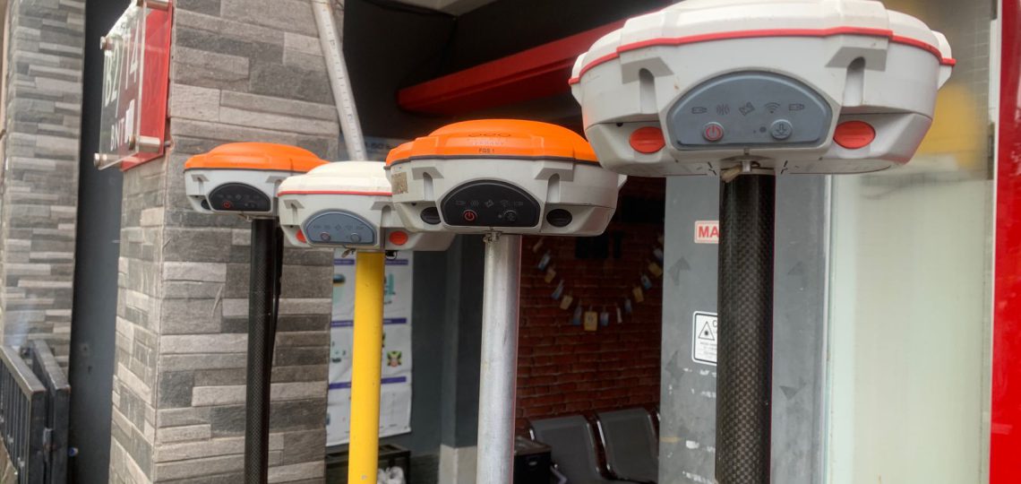
Results for "GPS RTK"

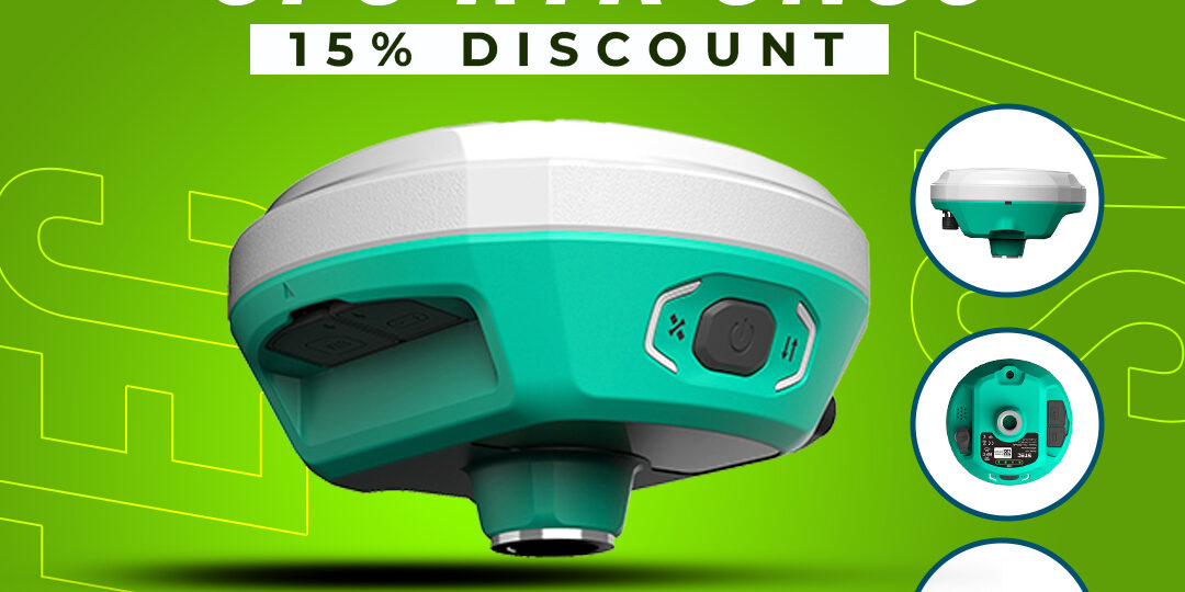
Spesifikasi GPS RTK STEC SV1 :

  • 1,408 channels
  • Support GPS, GLONASS, BDS, BEIDOU, GALILEO, SBAS, QZSS, L-band
  • Frekuensi 410-470 Mhz
  • 2 Sensors mega CMOS imaging sensors
  • Data Tranfer Type-C USB Transfer Supports FTP/HTTP download
  • Static H: 2.5mm±0.5ppm (RMS) V: 5mm±0.5ppm (RMS)
  • Real-time Kinematic H: 8mm±1ppm (RMS) V: 15mm±1ppm (RMS)
  • Battery Capacity 6800 mAh.
  • Unit ringan dengan berat 740gram
  • Penyimpanan 8gb SSD
  • Waterproof & Dustproof IP68


Note:
*Harga Dapat Berubah Sewaktu – waktu tanpa pemberitahuan terlebih dahulu.
*Mohon tanya ketersediaan barang terlebih dahulu.

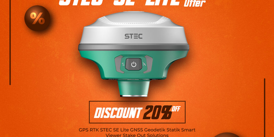
Spesifikasi Gps RTK STEC SE Lite :

  • 1,408 channels
  • Support GPS, GLONASS, BDS, BEIDOU, GALILEO, SBAS, QZSS, L-band
  • Frekuensi 410-470 Mhz
  • Data Tranfer Type-C USB Transfer Supports FTP/HTTP download
  • Static H: 2.5mm±0.5ppm (RMS) V: 5mm±0.5ppm (RMS)
  • Real-time Kinematic H: 8mm±1ppm (RMS) V: 15mm±1ppm (RMS)
  • Support NTRIP
  • Battery Capacity 10.200 mAh
  • Static mode 20 Jam
  • Rover mode 15 Jam
  • Unit dimensi terkecil dengan ukuran diameter  8cm x 10cm ( seukuran buah apel)
  • Penyimpanan 8gb SSD
  • Waterproof & Dustproof IP68

Note:
*Harga Dapat Berubah Sewaktu – waktu tanpa pemberitahuan terlebih dahulu.
*Mohon tanya ketersediaan barang terlebih dahulu.

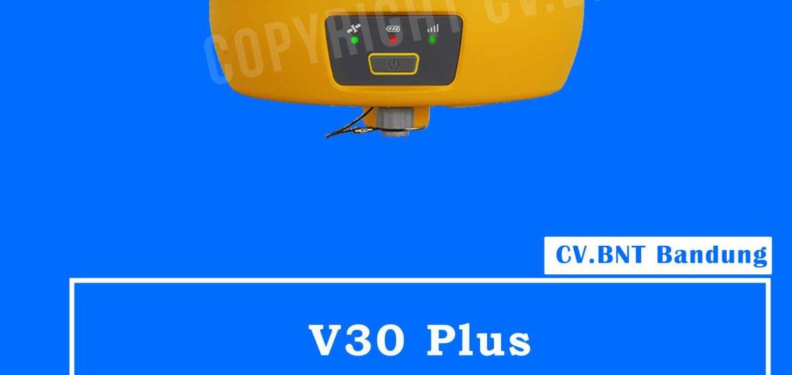
GPS Hi Target V30 Plus

KEY FEATURES:

  •  Multi-constellation GNSS engine.
    Auto-select satellite constellations, unique boundary control algorithm provide reliable location in harsh environments, 440 channels,extendable to 600.
  •  Smaller but smarter.
    Smaller size,164mm x 83.5mm, built-in integrated transceiver radio, one buttom multi-function, perfect compatibility with various CORS systems.
  • Smart application.
    Intelligent management of the static data. Standard Rinex data and Hi-Target raw data recorded simultaneously.
  • Practical Interface.
    Mini USB, USB Quick Upgrade Firmware,8G Storage, Support OTG, NFC Quick Connection.

Hallo sahabat survey saya akan sedikit membahas spesifikasi singkat tentang GPS RTK Hi – Target V30 plus di lengkapi dengan aplikasi:

  • Road
  • Railway
  • Bridge
  • Water conservancy
  • Regional geodesy
  • industry

Fitur GPS Hi- target V30 plus

  •  Dilengkapi dengan 800+ channel
  •  mesin gnss multi constellation
    melacak secara penuh untuk mencapai akurasi pemosisian yang akurat dan stabil.
  •  survey kemiringan dan electronic bubble
    dilengakapi dengan algoritma survey kemiringan yang dioptimalkan dan prosedur electronic bubble yang dapat mencapai corner point dan menggoyangkan reiciver.
  •  Teknologi Hi-fix
    dapat mengurangi watu downtime di lapangan dengan cangkupan RTK yang berkelanjutan selama correction outage dari base station rtk atau jaringan VRS.
  •  Antena udara berfrekuensi penuh
    Antena GNSS dengan gelombang penuh yang stabil dan tahan akan noise.
    mendukung berbagai sinyal pelacakan satelit
    mengurangi pengaruh efek multipath.
  •  Komunikasi Data
    kompitabel dengan protokol komunikasi vendor lain.
    jarak transmisi yang panjang, dan kompitabilitas elektromagnetic yang baik.
    sangat kompatibel dengan berbagai sistem CORS.

Spesifikasi GPS  Hi-Target V30+ Plus

Satellite Signals Tracked Simultaneously

  • Channels: 800+
  • GPS: L1/L2/L5/L2C
  • GLONASS: L1/L2/L3
  • BDS: B1/B2/B3/B1C/B2a
  • Galileo: E1/E5 AltBOC/E5a/E5b/E6
  • SBAS: L1/L5
  • QZSS: L1/L2/L5/L6
  • NavIC (IRNSS): L5
  • Global correction service: Hi-RTP (optional)
  • Base and Rover: Interchangeable

Positioning Performance

  • High Precision Static GNSS Surveying
    • Horizontal: 2.5 mm + 0.1 ppm RMS
    • Vertical: 3.5 mm + 0.4 ppm RMS
  • Static and Fast Static
    • Horizontal: 2.5mm + 0.5 ppm RMS
    • Vertical: 5 mm + 0.5 ppm RMS
  • Post Processing Kinematic (PPK / Stop & Go)
    • Horizontal: 8mm+1ppm RMS
    • Vertical: 15mm+1ppm RMS
    • Initialization time: Typically 10 min for base and 5 min for rover
    • Initialization reliability: Typically > 99.9%
  • Code Differential GNSS Positioning
    • Horizontal: 25cm+1ppm RMS
    • Vertical: 50cm+1ppm RMS
    • SBAS: 0.5 m(H), 0.85 m(V)
  • Network RTK
    • Horizontal: 8mm+0.5ppm RMS
    • Vertical: 15mm+0.5ppm RMS
    • Initialization time: Typically 2-10s
    • Initialization reliability: Typically > 99.9%
  • Real Time Kinematic (RTK)
    • Horizontal: 8mm+0.5ppm RMS
    • Vertical: 15mm+0.5ppm RMS
  • Hi-Fix
    • Horizontal: RTK + 10 mm/minute RMS
    • Vertical: RTK + 20 mm/minute RMS

Communication

  • Bluetooth: 4.0/2.1 +EDR, 2.4GHz
  • Network Communication:
    • 4G cellular mobile network (TDD-LTE, FDD-LTE, WCDMA, EDGE, GPRS, GSM)
    • Wifi frequency is 2.4G, support 802.11b/g/n protocol.

Internal UHF Radio

  • Frequency: 403-473Mhz
  • Channels: 116 (16 scalable)
  • Transmitting power: 1W/2W/4W adjustable
  • Support Multiple protocols:
    • HI-TARGET
    • TRIMTALK450S
    • TRIMMARK III
    • TRANSEOT
    • SATEL-3AS,
    • etc.
  • Working Range: Typically 3~5km, optimal 5~8km

External UHF Radio

  • Frequency: 410~470MHz
  • Channel: 8
  • Transmitting power: 5W/25W adjustable
  • Support Multiple Protocols: TRIMTALK450S, TRIMMARK III, TRANSEOT

Power Supply

  • Internal Battery
    • 5000mAh lithium-ion rechargeable and removable battery.
    • RTK Rover (UHF/Celullar) for 10 hours.
  • External Power
    • 6-28V DC External power input (5-pin port) with over-charge protection.
    • Power Consumption: 4.2 W

Physical

  • Dimension (W x H): 164mm x 83.5mm
  • Weight: ≤ 1.4kg (includes battery)
  • Data storage: 8GB ROM internal storage

Control Panel

  • Physical Button: 1
  • LED Lamp: Satellite, Signal, Power

Environment

  • Water/Dustproof: IP67
  • Shock and Vibration: Dsurvive a 2m natural fall on to ground
  • Humidity: 100%, condensing
  • Operation Temperature: -45°C ~+ 75°C
  • Storage Temperature: -55°C ~+ 85°C

I/O Interface

  • 1 x Mini USB Port
  • 1 x TNC antenna connector
  • 1 x DC power input (5-pin)
  • 1 x SIM card slot

Data Formats

  • Output Rate: 1Hz-20Hz
  • Static data format: GNS, Rinex
  • Network model: VRS,  supports NTRIP protocol
  • CMR& RTCM: CMR, RTCM 2.x, RTCM 3.0, RTCM 3.2
  • Navigation Outputs ASCII: NMEA-0183

Note:
*Harga Dapat Berubah Sewaktu-waktu tanpa pemberitahuan terlebih dahulu.
*Mohon tanya ketersediaan barang terlebih dahulu.

GPS RTK GNSS Comnav T300 

ComNav T300 GNSS Receiver, RTK System, 256 channels

  • GPS L1/L2/L5, BeiDou B1/B2/B3, GLONASS L1/L2
  • Low power consumption
  • Support long base line E-RTK
  • Signal Tracking
  • Channels 256 channels with simultaneously tracked

satellite signals

  • GPS L1 C/A, L1C, L2 P, L5
  • BeiDou B1, B2, B3
  • GLONASS L1, L2
  • Galileo Reserved
  • SBAS WAAS, EGNOS, MSAS,GAGAN

Performance Specifications

  • Cold start <50s
  • Warm start <30s
  • Hot start <15s
  • Initialization time 10s
  • Signal re-acquisition <2s
  • Initialization reliability Typically>99.9%

Positioning Specifications

  • Post Processing Static
  • Horizontal: 2.5 mm + 0.5 ppm RMS
  • Vertical: 5 mm + 0.5 ppm RMS
  • Real Time Kinematic
  • Horizontal: 8 mm + 1 ppm RMS
  • Vertical: 15 mm + 1 ppm RMS
  • E-RTK (<100km)
  • Horizontal: 0.2 m + 1 ppm RMS
  • Vertical: 0.4 m + 1 ppm RMS
  • Code differential GNSS positioning
  • Horizontal: 0.25 m+ 1 ppm RMS
  • Vertical: 0.5 m + 1 ppm RMS
  • SBAS Typically < 1 m 3D RMS
  • Standalone <1.5 m 3D RMS

Communications

  • Communication port
  • 1 Serial port (7 Pin Lemo), Baud rates up to 921,600 bps
  • Radio modem Tx/Rx with full frequency range from 410-470 MHz2
  • Transmit power: 0.5-2W adjustable
  • Range: 1-4km
  • Positioning data outputs 1HZ, 2HZ, 5HZ, 10HZ, 20HZ
  • Indicating light 5 LEDs (indicating Power, Satellite Tracking, Bluetooth and Data Recording)
  • Bluetooth V 2.X protocol, work compatible with Win

Note:
*Harga Dapat Berubah Sewaktu – waktu tanpa pemberitahuan terlebih dahulu.
*Mohon tanya ketersediaan barang terlebih dahulu.

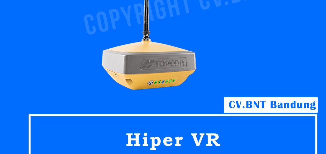
Topcon Hiper VR

Top features include:

  • Universal tracking technology for all satellites and constellations (GPS, GLONASS, Galileo, Beidou, IRNSS, QZSS, SBAS) covering all modernized signals
  • Field tested, field ready IP67 design
  • Compact form factor ideal for Millimeter GPS and Hybrid Positioning
  • Revolutionary 9-axis IMU and ultra-compact 3-axis eCompass
  • Integrated 400 MHz UHF Tx/Rx Radio Modem
  • Integrated License free 900 MHz Radio Modem, FH915 protocol

Specifications

  •  PELACAKAN GPS
    Jumlah Saluran : 226 dengan teknologi Universal Tracking Channels ™ yang dipatenkan Topcon
  • Sinyal Dilacak
    Sinyal GPS: L1 C / A, L1C * L2C, L2P (Y), L5 **
    GLONASS: L1 C / A, L1P, L2C / A, L2P, L3C *
    Galileo: E1 / E5a / E5b / Alt-BOC BeiDou / BDS: B1, B2
    IRNSS: L5 *** SBAS: WAAS, EGNOS, MSAS, GAGAN (L1 / L5§)
    L-band: TopNET Global D & C Koreksi layanan
    QZSS: L1 C / A, L1C, L1-SAIF, L2C, L5
    * L1C saat sinyal tersedia.
    ** L3C saat sinyal tersedia.
    *** L5 saat sinyal tersedia.
  • AKURASI
    Statis Cepat (L1 + L2) H: 3 mm + 0,4 ppm V: 5 mm + 0,5 ppm
    RTK (L1 + L2) H: 5 mm + 0,5 ppm V: 10 mm + 0,8 ppm
    Sensor Kemiringan Kompensator * * Sudut maksimum yang disarankan untuk kompensasi kemiringan adalah 15 ° H: 1,3 mm / ° Kemiringan; Kemiringan ≤ 10 ° V: 1,8 mm / ° Kemiringan; Miringkan> 10 °
  • DGPS 0,25 m HRMS
  • TENAGA dan KELISTRIKAN
    Waktu Operasi Mode RX
    10 jam mode TX 1W – 6 jam
  • UMUM
    Radio 425-470 MHz radio UHF Max Transmit Power: 1W Jangkauan: 5-7 km tipikal; 15 km
    Memori Internal SDHC 8 GB Non-removable
  • FISIK dan LINGKUNGAN
    Perlindungan Ingress IP67
    Pengoperasian Temperatur -40ºC sampai 65ºC
    Kelembaban 100%, kondensasi
    Drop Test 1,0 m jatuh ke beton. Tiang 2,0 m jatuh ke beton.
    Dimensi 150 x 100 x 150 mm (w x h x d)
  • Berat <1,15 kg

Note:
*Harga Dapat Berubah Sewaktu – waktu tanpa pemberitahuan terlebih dahulu.
*Mohon tanya ketersediaan barang terlebih dahulu.


Jual GPS RTK Geodetik Second dengan harga terjangkau berkualitas dan bergaransi. 1 Set GPS RTKComnav T-300 GNSS 1 Set GPS RTK Geofennel FGS1 GNSS 1 Ser GPS RTK Satelit S1 GNSS sudah termasuk aksesoris dan siap pakai, untuk harga bisa calling saja (081222229059) fast respone cek sepuasnya di kantor. sekedar informasi , untuk kalian yang baru merintis proyek sangat di anjurkan membeli alat bekas dikami karena terjamin alat berfungi dengan baik dan harga bersahabat.

Mencari alat survey dengan tingkat akurasi tinggi namun terbentur anggaran? Jual GPS RTK Geodetik GNSS Bekas (Second) di CV. BNT adalah solusi cerdas untuk kebutuhan pemetaan dan konstruksi Anda. Anda tetap mendapatkan performa handal dan akurasi sentimeter tanpa harus membayar harga unit baru.

Semua unit second yang kami sediakan telah melalui proses inspeksi teknis yang ketat (QC) untuk memastikan seluruh fungsi penangkapan satelit, base, dan rover berjalan dengan optimal di lapangan.

Harus Tau

Buat sahabat survey yang tidak tahu apa kelebihan membeli GPS RTK GNSS Bekas di cv.bnt kami berikan alasannya kenapa kalian harus beli alat di CV.BNT :

  1.  GPS RTK GNSS bekas Bergaransi Resmi.
  2.  Toko milik sendiri jelas dan berlegalitas.
  3.  Siap melakukan transaksi seluruh indonesia.
  4.  Free pelatihan dasar GPS RTK GNSS (syarat ketentuan berlaku).
  5.  Klaim garansi no ribet.
  6.  Free Konsultasi alat GPS RTK GNSS yang cocok untuk proyek kalian sedang kerjakan. dan yang paling penting CV.BNT sudah MOU dengan beberapa BUMN dan Dinas.