Results for "GPS RTK ComNav"

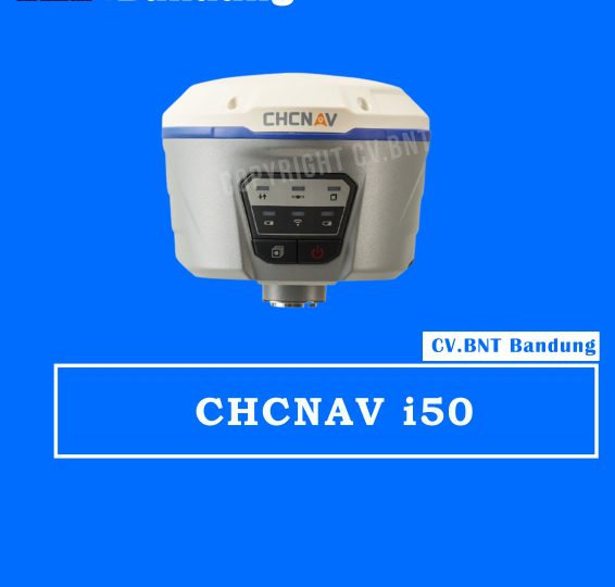
GPS RTK GNSS CHCNAV I50

Description:
The CHCNAV i50 GNSS receiver brings speed and accuracy in one easy-to-use GNSS solution to complete your surveying and construction projects efficiently.
Combined with CHCNAV LandStar 7 field software and HCE320 Android controller, the i50 is the perfect surveying solution for topographic and construction positioning tasks.

Key Features

  • 634 Channels Full GNSS
  • Extended Connectivity
  • Flexible Work Modes</li>
  • Rugged and Co
  • mpact
  • Extra Power

Specifications:

  • Power
    Operating power: min. (V) 7.4
    Operating power: max. (V) 36
    Typical consumption (W) 4.2
    Internal power supply 7.4
    External power 9 – 36
    Operating time with internal power supply (hr) 12
    Certifications CE
  • Environment
    Operating temperature: min. (°C)-40
    Operating temperature: max. (°C) 65
    Humidity resistance 95%
    Water sand and dust proof IP67
    Shock and vibration proof 2-meter pole drop
  • Performance
    No. channels 432
    Tracked satellite signals GPS, GLONASS, Galileo, BeiDou, SBAS, QZSS
    SBAS differential signals L1
    Type of measurements RTK, PPK, Static
    Reacqisition time (s) <1s
    RTK Network Compatibility >99.9%
  • Horizontal Uncertainty
    code: DGNSS/RTC (constant part) (m) 1.5
    code: DGNSS/RTC (variable part) (ppm) 3.0
    phase: RTK kinematic (constant part) (m)0.017
    phase: RTK kinematic (variable part) (ppm) 1
    phase: static post processing (constant part) (m)0.006
    phase: static post processing (variable part) (ppm) 0.5


Note:
*Harga Dapat Berubah Sewaktu – waktu tanpa pemberitahuan terlebih dahulu.
*Mohon tanya ketersediaan barang terlebih dahulu.
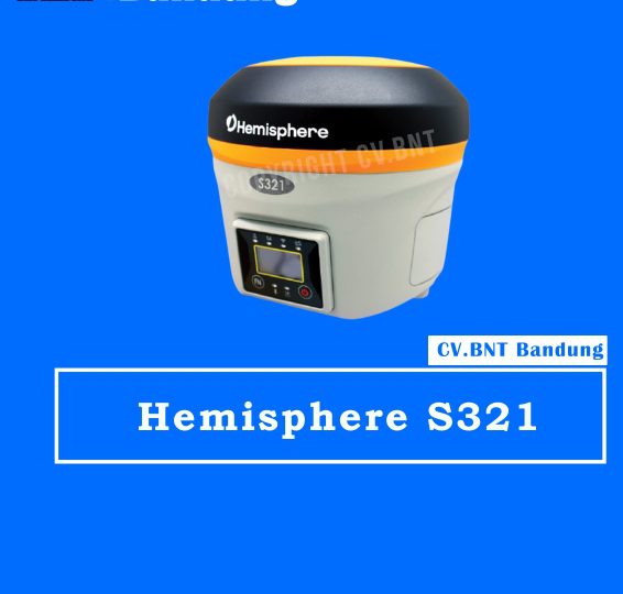
GPS RTK GNSS Hemisphere S321

S321 adalah multi-GNSS multi-frekuensi, smart antenna baru dari Hemisphere.
S321 memberikan kinerja yang tangguh dan presisi tinggi dalam paket yang ringkas dan kasar.
Dengan beberapa port komunikasi nirkabel dan antarmuka GNSS terbuka, S321 dapat digunakan dalam berbagai mode operasi.
Gunakan S321 sebagai stasiun pangkalan yang tepat mengirim RTK ke jaringan rover yang ada

FITUR UTAMA:

  • Mesin Athena RTK
  • GPS, GLONASS, BeiDou, Galileo, QZSS
  • 372 saluran
  • Koreksi Atlas disampaikan melalui L-band dan melalui Internet
  • Konektivitas nirkabel melalui Bluetooth dan Wi-Fi
  • UI web yang kuat
  • Dua versi (Masing-masing dapat digunakan sebagai Base atau Rover):
    – UHF GSM / WCDMA
    – GSM / WCDMA (Network Rover)
  • Kartu memori internal 4 GB dan kartu MicroSD berkemampuan 64 GB untuk mencatat, mengunduh, dan mengunggah data.


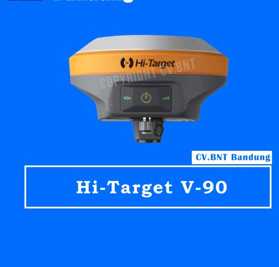
GPS RTK HI-TARGET V90

Fitur :

  • Kecil dan ringan
  • Beratnya hanya 950g.
  • Ukuran Diameter 153mm x Tinggi 83mm.

Pelacakan Multi-konstelasi GPS Geodetik RTK

  • 220 saluran pelacakan
  • Mendukung GPS, GLONASS, GALILEO, BDS, SBAS
  • NGS menyetujui antena GNSS pita penuh

Aplikasi Cerdas

  • Menawarkan survei kemiringan dengan sudut kemiringan maksimum 30 derajat.
  • Mendukung kalibrasi gelembung elektronik
  • Modul NFC internal membuat komunikasi Bluetooth cepat dan mudah.
  • Bantuan suara yang cerdas memandu operasi lapangan. Suara bisa DIY.
  • Data Rinex standar dan data mentah HI-TARGET direkam secara bersamaan.

Radio UHF Transceiver Opsional

  • Radio UHF transceiver memungkinkan mode kerja yang dapat dialihkan antara basis dan penjelajah.
  • Tiga jenis radio UHF internal menyediakan frekuensi yang berbeda berdasarkan kebutuhan pengguna. Radio UHF internal Pacific Crest TrimTalk © kompatibel dengan radio lain.

Koneksi Multi Jaringan

  • Mendukung GPRS, GSM dan WCDMA
  • Mendukung WIFI

Baterai yang Kuat

  • Didukung oleh baterai Li-ion berkapasitas tinggi (5000mAh) untuk memastikan pengoperasian sehari penuh

Desain Kasar

  • IP67 tahan debu dan tahan air
  • Mampu bertahan saat jatuh 3 meter secara alami ke beton


POSITIONING KINERJA

Statik dan Statik Cepat GNSS Survei

  • Horisontal …………………… 2.5mm + 0.5ppm RMS
  • Vertikal…………………………. 5mm + 0.5ppm RMS
  • Post Processing kinematik (PPK / Stop & Go) GNSS Survei
  • Horisontal ……………………… .. 1cm + 1ppm RMS
  • Vertikal ………………………… 2,5 cm + 1ppm RMS
  • Waktu inisialisasi ……… .Typically 10 menit untuk basis sementara 5 menit untuk rover
  • Kehandalan inisialisasi …… Biasanya> 99,9

Real Time Kinematik (RTK) Survei

Base Absolute

  • Horisontal ……………………… .. 8mm + 1ppm RMS
  • Vertikal…………………………. 15mm + 1ppm RMS
  • Jaringan RTK
  • Horisontal ……………………… .. 8mm + 0.5ppm RMS
  • Vertikal ………………………… .. 15mm + 0.5ppm RMS
  • Waktu inisialisasi …… .. … Biasanya <8 detik
  • Kehandalan inisialisasi …… .Typically> 99,9%
  • Positioning kode Differential GNSS
  • Horisontal………………………. 25cm + 1ppm RMS
  • Vertikal …………………………… 50cm + 1ppm RMS
  • SBAS ……… 0.50m Horizontal, Vertikal 0.85m

HI-TARGET Internal UHF Radio (Standard)

  • Frekuensi … 450 ~ 470MHz dengan 116 saluran
  • Daya transmisi … 0.5W, 1W, 2W disesuaikan
  • Kecepatan transmisi ……… .9.6Kbps, 19.2Kbps
  • jarak antara base dan rover ………… 0,3 ~ 5km khas, 8 ~ 10kmoptimal
  • Pacific Crest XDL Micro internal UHF Radio
  • Frekuensi …………………………… 0,403 ~ 473MHz
  • Transmisi daya ……………… 0.5W, 2W disesuaikan
  • Transmisi kecepatan …………….. Sampai 19.2Kbps
  • Mendukung sebagian besar protokol komunikasi radio
  • jarak antara base dan rover ……………………… 3 ~ 5 kilometer khas, 8 ~ 10km optim

HI-TARGET Internal UHF Radio (Standard)

  • Frekuensi … 450 ~ 470MHz dengan 116 saluran
  • Daya transmisi … 0.5W, 1W, 2W disesuaikan
  • Kecepatan transmisi ……… .9.6Kbps, 19.2Kbps
  • jarak antara base dan rover ………… 0,3 ~ 5km khas, 8 ~ 10kmoptimal
  • Pacific Crest XDL Micro internal UHF Radio
  • Frekuensi …………………………… 0,403 ~ 473MHz
  • Transmisi daya ……………… 0.5W, 2W disesuaikan
  • Transmisi kecepatan …………….. Sampai 19.2Kbps
  • Mendukung sebagian besar protokol komunikasi radio
  • jarak antara base dan rover ……………………… 3 ~ 5 kilometer khas, 8 ~ 10km optim

SISTEM KONFIGURASI

Sistem

  • Penyimpanan data 16GB internal storage (Mendukung hingga 32GB SD card eksternal)
  • Rekam GNS dan Format RINEX secara bersamaan


Data Format

  • Output posisi 1HZ, hingga 20Hz
  • CMR : CMR, CMR +, sCMRx input dan output
  • RTCM : RTCM 2.1, 2.3, 3.0, 3.1, 3.2 input dan output
  • Navigasi output ASCII : NMEA-0183 GSV, AVR, RMC, HDT, VGK, VHD, ROT, GGK, GGA, GSA, ZDA, VTG, GST, PJT, PJK, BPQ, GLL, GRS, GBS
  • Navigasi output biner : GSOF

Note:
*Harga Dapat Berubah Sewaktu – waktu tanpa pemberitahuan terlebih dahulu.
*Mohon tanya ketersediaan barang terlebih dahulu.
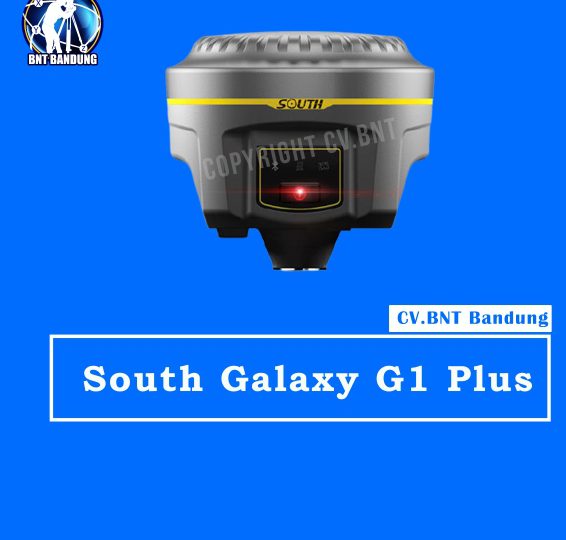
GPS RTK South Galaxy G1 plus

FEATURES:

  1.  Behind every significant epoch-making change in human society, always accompanied by the birth of an important technology.
  2. Computer and electronics make surveying and mapping industry achieve a span from the analog age to the digital age.
  3. And the development of Internet technology further opens the prelude of surveying and mapping information age.

SPESIFICATION:

GNSS performance

  • Channels: 336, 555 (optional)
  • GPS : L1 C/A, L2E, L2C, L5
  • Positioning output rate : 1Hz~50Hz
  • Initialization time : <10s
  • Initialization reliability : >99.99%

Positioning precision

Static surveying

  • Horizontal: 2.5mm+0.5ppm
  • Vertical : 5mm+0.5ppm

Code differential positioning

  • Horizontal: 0.25m+1ppm
  • Vertical : 0.50m+1ppm

Real-time kinematic surveying

  • Horizontal: 8mm+1ppm
  • Vertical : 15mm+1ppm

RTX

  • Horizontal: 4-10cm (5-30min)
  • Vertical : 8-20cm (5-30min)

User interaction

  • Operaing system : Linux
  • Buttons : 2 buttons operation
  • Indicators: 5 indicate lights
  • Web UI : Freely to configure and monitor the receiver by accessing to the web server via Wi-Fi and USB

Hardware performance

  • Dimension: 135mm (Diameter) x 125mm (Height)
  • Weight : 1.39kg (with two batteries)
  • Material : Magnesium aluminum alloy shell
  • Operating temperature : -30°C~ +65°C
  • Storag temperature: -40°C~ +80°C
  • Power Supply: 9-25V DC, overvoltage protection
  • Battery : Rechargeable, removable Lithium-ion battery, 7.4V 3400mAh/per

Communications

  • I/O port : 5-PIN LEMO external power port + RS232, 7-PIN external USB(OTG)+Web accessing, 1 radio antenna interface, SIM card slot
  • Frequency Range: 410-470MHz
  • External Devices: Optional external GPRS/EDGE dual-mode communication module, switchable

Data storage/ Transmission

  • Data Storage : 8GB SSD internal storage, changeable record interval, up to 50Hz raw data collection
  • Data Format (Static data format) : STH, Rinex2.x and Rinex3.x


Note:
*Harga Dapat Berubah Sewaktu – waktu tanpa pemberitahuan terlebih dahulu.
*Mohon tanya ketersediaan barang terlebih dahulu.


GPS Garmin 585 Plus Fish Finder

Deskripsi GPS Garmin 585 Plus Fish Finder SEA ClearVu GPS Fish Finder

Physical & Performance
* Physical dimensions : 176.0 mm x 190.0 mm x 66.0 mm (6.93” x 7.48” x 2.60”)
* Display size, WxH : 2.83″ x 5.36″; 6.0″ diagonal (72.0 mm x 136.2 mm; 152.4 mm diagonal)
* Display resolution, WxH : 480 x 800 pixels
* Display type : WVGA display
* Water rating : IPX7
* GPS receiver : GPS/GLONASS/BeiDou, internal
* NMEA 0183/RS422 compatible : Yes
* Power consumption : 7.6 W
* Mounting options : Bail or flush

Maps & Memory
* Preloaded maps : GPSMAP 585 Plus, APAC (worldwide basemap)
* Accepts data cards : 2 standard SD
* Waypoints : 12,000
* Routes : 200
* Track log : one 50,000 points active track; 100 saved tracks

WHAT’S IN THE BOX:
* GPSMAP 585 Plus display
* GT20-TM Transducer
* GA38 Antenna
* Power/data cable
* Bail mount
* Documentation


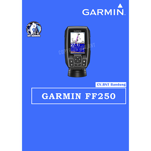
Gps Garmin FF250

Deskripsi Garmin FF 250 GPS Fisfinder, GPSMAP 585 alternatif

Garmin FF 250 GPS & Fisfinder
3.5-inch CHIRP Fishfinder with GPS

Bahasa Melayu
Garansi 2 tahun

Sebagai alternatif dari Garmin GPSMAP 585, dimana setiap unit FF 250 sdh termasuk transduser Garmin CHIRP (77/200 kHz), yang memberikan tingkat kejelasan dan detail yang jelas melihat ikan dan struktur dibandingkan transduser 77/200 kHz model lama.

Alih-alih hanya mengirimkan satu frekuensi tunggal, CHIRP mengirimkan frekuensi secara terus menerus, mulai dari freq. rendah sampai tinggi, lalu menafsirkannya satu per satu. Sehingga menghasilkan gambar yang jauh lebih baik dan detail seperti gambar ikan yang lebih jelas.

OVERVIEW:
One new Over Voltage Protection design that with an special over voltage protection feature to protect the device from high over voltage and suddenly surge condition that could occur occasionally from the semi-commercial environment.
Easy-to-use 3.5-inch color fishfinder with built-in, high-sensitivity GPS
Find fish; mark and return to hot spots, docks and ramps
Convenient keypad operation
Includes CHIRP (77/200 kHz) sonar transducer; transmit power (200 W RMS)/(1,600 W peak-to-peak)
Upgrade to high performance CHIRP with a GT8 or GT15 transducer (each sold separately)

KEY FEATURES:
* Experience the Clarity of CHIRP
* Mark Spots with High-sensitivity GPS
* Navigate Easily with Waypoint Map
* Check Your Speed on Screen
* Fish Vertically with Built-in Flasher
* Take Your Fishfinder Anywhere

WHAT’S IN THE BOX:
* FF 250 GPS
* Dual-beam transducer
* Transom and trolling motor mounts
* Tilt/swivel mount
* Power cable
* Documentation