Results for "alat lab"

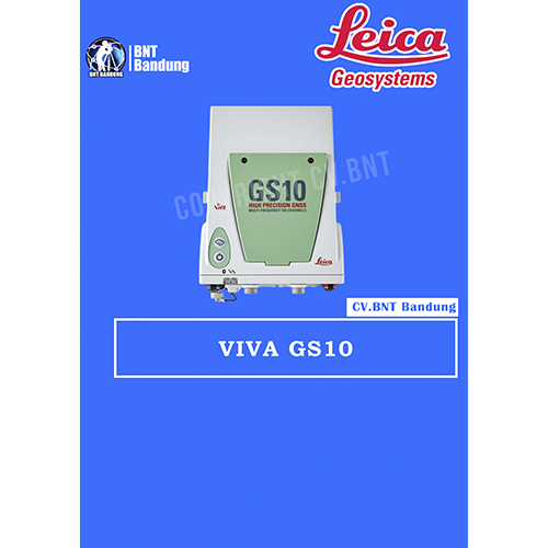
GPS Geodetik RTK GNSS Lieca GS10

The Leica Viva GS10 and GS25 high-precision receivers combine all features to provide peak performance, even under the most demanding conditions. Rest assured you are receiving the most accurate results when you count on the positioning reliability of the Viva GS10 and GS25.

Ensure today’s and tomorrow’s success with these outstanding GNSS receivers that offer upgrade functionality options to adapt with advancing satellite positioning systems. Regardless of the task at hand, enjoy the confidence that comes with a job well done using the Viva GS10 and GS25.

The Leica Viva GS10 and GS25 receivers also deliver with:

Engaging software
The Leica Viva GS10 and GS25 receivers come with the revolutionary Leica Captivate software, turning complex data into the most realistic and workable 3D models. With easy-to-use apps and familiar touch technology, all forms of measured and design data can be viewed in all dimensions. Captivate spans industries and applications with little more than a simple swipe, regardless of whether you work with GNSS, total stations or both.

Infinite possibilities
While Captivate captures and models data in the field, Leica Infinity software processes the information back in the office. A smooth data transfer ensures the project stays on track. Captivate and Infinity work in conjunction to join previous survey data and edit projects faster and more efficiently.

Customer care at a click
Through Active Customer Care, a global network of experienced professionals is only a click away to expertly guide you through any problem.

  • Eliminate delays with superior technical service
  • Finish jobs faster with excellent consultancy support
  • Avoid costly site revisits with online service to send and receive data directly from the field

Control your costs with a tailored Customer Care Package, giving you peace of mind you’re covered anywhere, anytime.

Powerful handheld devices
In a controller or a tablet, take your entire office on the go when you discover the power to overcome any environment from the palm of your hand.  The Leica CS20 controller and Leica CS35 tablet provide the ultimate in control and convenience with complete mobility. Touch screen technology allows for comfortable and quick data processing while a stunning 3D view transforms your Leica Viva GNSS experience.

 

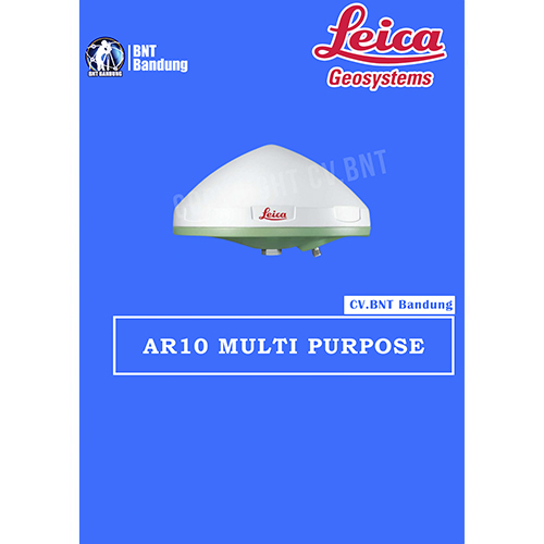
GPS Geodetik RTK GNSS Lieca AR10

An all new antenna design, together with a large ground plane and integrated radome, ensures that the AR10 provides exceptional signal tracking, phase centre accuracy and multipath suppression.

Integrated radome
Thanks to the integrated radome, the Leica AR10 prevents build up of snow which could otherwise degrade signal quality.The non-spherical radome is designed for optimal signal quality and has the added benefit of discouraging birds from perching on the antenna, a common source of signal attenuation with rounded radomes. The aerodynamic shape of the antenna reduces wind loading and together with the light weight ensures that the Leica AR10 can be used with a variety of antenna masts or as a field or campaign base on a tripod. Constructed using a robust and UV resistant enclosure the Leica AR10 is made to withstand extreme temperature, humidity, dust, salt, solar radiation, pollution, shock and vibration.

Superior performance
Designed from the ground up for wideband tracking, the new wideband antenna technology introduced in the Leica AR10 provides superior low elevation tracking, multipath suppression and antenna phase centre accuracy across all frequency bands. An all new low noise amplifier (LNA) is used to provide exceptional low measurement noise for superior measurement quality. The new LNA technology also has excellent out of band rejection, helping to significantly reduce potential interference due to jamming. The Leica AR10 is suitable for use with antenna cable lengths up to 70 m without the need for an in-line amplifier.

Future proof
With emerging satellite systems close on the horizon, such as the European Galileo system and the Chinese Compass (Beidou 2) system, it is more important than ever before to have a true GNSS antenna. In line with Leica Geosystems “future proof” philosophy, the Leica AR10 has been designed for all existing and currently planned signals of the GPS, GLONASS, Galileo and Compass global navigation satellite systems and the SBAS, QZSS, Gagan, OmniSTAR and other L-band augmentation systems.


GPS Geodetik RTK GNSS Horizon Cronos C3

HORIZON GPS GEODETIK KRONOS 300
• The Kronos 300 is a GNSS receiver that allows you to do more, a HORIZON GNSS product which continues with the tradition of performance excellence shown by the Kronos 200 GNSS system. It now features a more robust and rugged housing, within which resides a faster and more powerful BD970 boardbuilt on the proven Maxwell 6 technology. Like the Kronos 200, the Kronos 300 also features an in-built GSM/GPRS module, as well as an in-built UHF transmitter module for a complete communication interface. The UHF modulehas been upgraded to a power-switchable type, which would allow atransmission range of beyond 8 km independently.

Spesifikasi Horizon Kronos 300:
• 220 Channel
• GPS GLONNAS QZSS
• GALILEO SBAS Beidou
• L1 L2 L5
• Statik 3mm
• RTK 8mm
• Outsanding waterproof IP67


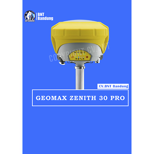
GPS Geodetik RTK GNSS Geomax Zenith 35

Spektrum penuh dari sinyal satelit, konektivitas penuh, dan fungsi Tilt & Go yang unik semuanya dalam GNSS yang ringkas menjadikan seri Zenith35 Pro GNSS yang berfungsi saat Anda melakukannya.

Sebuah sudut gedung atau bahkan selokan di bawah mobil yang diparkir? Fungsi Zenith35 Pro Tilt & Go yang unik memungkinkan Anda untuk mengukur titik di mana penempatan vertikal tiang tidak mungkin, seperti sudut-sudut rumah.


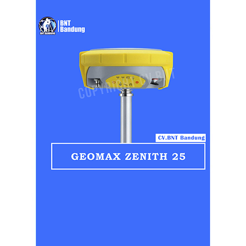
GeoMaz GNSS Zenith 25

Equipped with the most advanced GNSS receiver technology,
Zenith25 Pro series supports GPS, GLONASS, Galileo, BeiDou,
and SBAS systems. Suitable for any application, the Zenith25
Pro series additionally considers new GNSS constellations
like BeiDou and Galileo today and is prepared for even more
signals tomorrow.

*BeiDou tracking B1,B2

Galileo tracking E1, E5b
Positioning rate 20Hz*, 5Hz
SBAS EGNOS, WAAS, MSAS, GAGAN

ACCURACY
Static H/ V (mm + ppm) 3 + 0.5 / 5 + 0.5
Static long H/ V (mm + ppm) 3 + 0.1/ 3.5 + 0.4
Kinematic H/ V (mm + ppm) 8 + 1 / 15 + 1

**COMMUNICATION
GSM/GPRS module Quad-Band GSM & Penta-Band ; UMTS 800 /850 /900 /1900 /2100 MHz ;internal antenna
UHF radio module 000 mW transcei ver; 4 06480MHz
Bluetooth Device class II
Communication port USB, serial and power

**INTERFACES
Keyboard On/off and function keys
LED status and mode indicators Position, battery, Bluetooth
,RTK receive, RTK transmit, storage card ;
Rover, base, static

Data recording GSM / TCP / IP

GeoMax Zenith15 adalah receiver GNSS yang lengkap dan terintegrasi penuh, yang memungkinkan pelacakan sistem GPS dan GLONASS. Tersedia sebagai model GSM atau GSM-UHF Zenith 15 adalah pilihan ekonomis Anda.GeoMax Zenith15 adalah receiver GNSS yang lengkap dan terintegrasi penuh, yang memungkinkan pelacakan sistem GPS dan GLONASS. Tersedia sebagai model GSM atau GSM-UHF Zenith15 adalah pilihan ekonomis Anda.

The GeoMax Zenith15 is a complete and fully integrated GNSS receiver, allowing tracking GPS and GLONASS systems. Available as GSM or GSM-UHF model Zenith15 is your economic choice.

COMPACT
Integrated GSM antenna
Quick swappable SIM & microSD card
Complete control with receiver keypad

HIGH PERFORMANCE
NovAtel® technology
GPS, GLONASS & SBAS
GSM/GPRS, UHF radio & Bluetooth®

MIX & MATCH
Combine with your preferred datalogger and software
Open connectivity
Complete setup flexibility

Spesifikasi :
Q-Lock technology : Lowest noise and multipath mitigation
Satellites (Max. number tracked simultaneously) : 60
Channels : 120
GPS tracking : L1, L2, L2C
Glonass tracking : L1, L2
Positioning rate : 5Hz
SBAS : EGNOS, WAAS, MASAS, GAGAN

Accuracy
Static H/V (mm + ppm) : 5 + 0.5 / 10 + 0.5
Static long H/V (mm + ppm) : 3 + 04 / 3.5 + 0.4
Kinematic H/V (mm + ppm) : 10 + 1 / 20 + 1

Communication
GSM/GPRS module : Quad-Band GSM & Penta-Band; UMTS 800/850/ 900/ 1900/ 2100 Mhz; internal antenna
UHF radio module : 1000 mW transceiver, 406 – 480 MHz
Bluetooth : Device class II
Communication port : USB, serial and power

Power Supply
External power / Internal battery : 10.5 V to 28 v / Removable 2.6 Ah ; 74 V
Operating time (static/rover) : 7.5 h / 5 h

Interfaces
Keyboard : On/Off and function keys
LED status and mode indicators : Position, battery, Bluetooth, RTK transmit, storage card; Rover, base, static
Data recording : 8Gb removable microSD card
GSM / TCP / IP : Removable SIM card