Results for "alat lab"

GPS RTK GNSS Topcon Hiper GA

If you need an economical RTK solution that provides advanced technology, wireless system design, and rugged, waterproof construction, it’s time to think green. It’s time for Topcon and the new Green Label HiPer receivers!

Features & Benefits

      • Innovative, cable-free system design
      • Complete GPS and Glonass satellite system tracking with OAF
      • Advanced Digital Radio Communications System

    <

li>Integrated B

    luetooth Wireless Technology

  • Powerful 40 channel GNSS board operating at up to 20Hz
  • User selectable and upgradeable internal memory
  • Rugged, waterproof, field proven system design
Built on Topcon’s field-proven, reliable HiPer series platform, HiPer Ga and HiPer Gb RTK receivers offer the latest in advanced technology and sophisticated design at an extremely affordable price. Like Topcon’s other popular HiPer series receivers, the HiPer Ga and Gb feature an “all-in-one” design eliminating the hassles of hauling around multiple components and cables vulnerable to loss, breakage, and the everyday punishment of the job site.

Both of these receivers feature Topcon’s new, state-of-the-art digital radio. As with current cellular technology, digital radios have replaced outdated analog systems because of their superior signal quality, robust performance, and advanced interference suppression. Another Topcon World’s First, the leader in providing advanced technology to the positioning industry.

Topcon HiPer Ga

The HiPer Ga features GPS satellite tracking capability standard, with the added bonus of optional GLONASS satellite tracking upgradeability via OAF activation code. Software-based OAF upgradeability means there’s no hardware changes or modifications required. Your local Topcon dealer can upgrade your HiPer Ga while you wait in most cases.The HiPer Ga can be configured as a cable-free base and rover system for traditional applications, or as two rover receivers from a fixed base station or a GNSS network system, via radio or cellular communication.

Topcon HiPer Gb

The HiPer Gb provides similar hardware functionality to the Ga, but with GPS only tracking capabilities and fewer upgradeability choices. The HiPer Gb is a very economical cable-free RTK base and rover system. The HiPer Gb provides a fully functional GPS RTK system that can also be used for traditional static observations, at a price that fits any budget.

If you’re looking for an economical RTK solution that provides advanced technology, wireless system design, and rugged, waterproof construction look no further. Topcon’s Green Label HiPer Ga and HiPer Gb are the cost-effective answer you’ve been waiting for!


Note:
*Harga Dapat Berubah Sewaktu – waktu tanpa pemberitahuan terlebih dahulu.
*Mohon tanya ketersediaan barang terlebih dahulu.

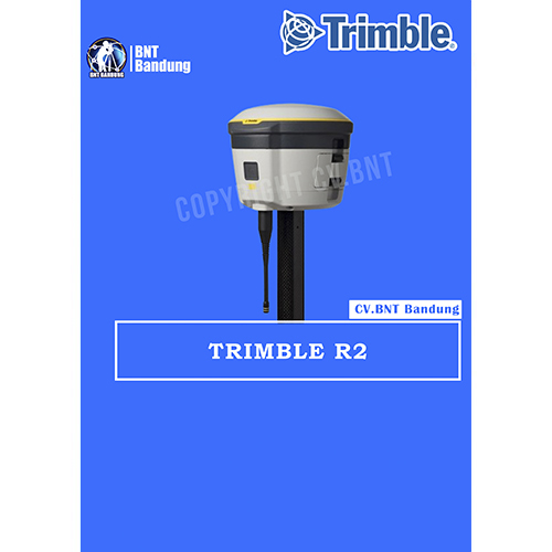
GPS Geodetik RTK GNSS Trimble R2

The Trimble® R2 is a compact, durable GNSS receiver that provides an easy-to-use solution for GIS and survey professionals who need to collect highly accurate data in a wide range of geospatial applications. Capable of delivering between submeter and centimeter positioning accuracy in real-time to any mobile device via a wireless Bluetooth® connection, the R2 receiver gives you total flexibility to choose a solution based on the accuracy and GNSS performance level that suits your application, letting you work the way you want.

  • Professional solution for GIS & survey applications ranging from submeter to centimeter accuracies
  • Easily collect data by pairing with devices such as smartphones, tablets or Trimble handhelds
  • Fast to setup, easy-to-use, keeping you productive and focused on your work
  • Supports multiple satellite constellations and correction sources for accurate data at any location
  • Compact, cable-free design with integrated antenna

High accuracy for survey & GIS applications

  • Capable of delivering submeter to centimeter level positioning accuracy in real-time to suit any field data collection application.
  • Achieve higher accuracy in real-time using correction sources from SBAS and VRS networks to Trimble RTX™ correction services*, delivered by either satellite or Internet, or via traditional RTK methods.
  • Supports multiple satellite constellations and augmentation systems to provide maximum accuracy and positioning performance.

* Trimble RTX available through Trimble applications

Flexible solution

  • Able to be paired with any mobile device on a variety of operating systems and platforms, from a Trimble handheld or controller to a modern smartphone or tablet.
  • You can select the accuracy and GNSS performance level appropriate for your application.
  • Capable of being operated either mounted on a pole, on a backpack or on a vehicle.
  • Integrates with Trimble software such as Trimble Access™, Trimble TerraFlex™ and Trimble Business Center to enable data to be easily collected, communicated and processed, providing you with high-quality deliverables for your organization.

Simple, rugged system

  • One-button start up and compact, streamlined design enables a quick setup.
  • Built to withstand tough conditions meeting military specifications MIL-810G for ruggedness and an IP65 rating.


Note:
*Harga Dapat Berubah Sewaktu – waktu tanpa pemberitahuan terlebih dahulu.
*Mohon tanya ketersediaan barang terlebih dahulu.
 

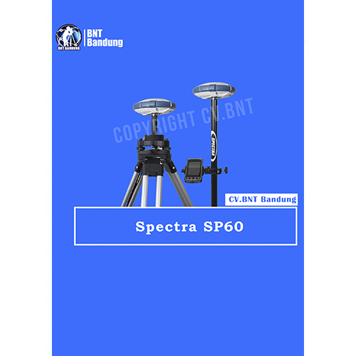
Key features :

Sangat skalabel dan serbaguna

Sangat skalabel dan serbaguna, SP60 dapat merespons segala jenis pekerjaan survei, mulai dengan solusi post-processing L1 GPS saja, hingga dual-frekuensi jaringan GNSS RTK . Juga, antena GNSS yang mampu menangkap L-band, memberikan posisi CenterPoint RTX di tempat-tempat di mana jaringan RTK tidak tersedia. Dengan adanya, radio transmisi UHF atau Bluetooth Jarak Jauh yang tertanam memungkinkan receiver SP60 untuk dapat digunakan pada segala medan.

New 240-channel 6G ASIC

Spectra Precision SP60 dapat menangkap 240-channel 6G ASIC sepenuhnya menggunakan semua 6 sistem GNSS: GPS, GLONASS, BeiDou, Galileo, QZSS dan SBAS. Kemampuan unik GNSS-centric secara optimal menggabungkan sinyal GNSS tanpa ketergantungan pada sistem GNSS tertentu; ini memungkinkan SP60 untuk beroperasi dalam mode GPS-only, only-GLONASS atau BeiDou-saja jika diperlukan. Berkat teknologi GNSS yang unik ini, SP60 dioptimalkan untuk melacak dan memproses sinyal bahkan di lokasi yang ekstrim.

Center Point RTX capable rover

Layanan CenterPoint RTX yang dikirimkan melalui satelit adalah layanan koreksi yang dikirmikan oleh satelit pengkoreksi yang paling akurat. Layanan ini tidak memerlukan Base Station RTK atau jaringan seluler. SP60 yang disertai dengan antena GNSS L-band, yang merupakan kemampuan CenterPoint RTX, sangat ideal untuk beroperasi di area di mana tidak ada jaringan yang tersedia , tanpa harus ada  pengaturan base dan rover lokal. Diaktifkan untuk menerima koreksi CenterPoint RTX yang dikirim melalui satelit, SP60 dapat memberikan posisi kurang dari 4 cm dalam waktu 30 menit atau kurang. Berkat teknologi CenterPoint RTX dan jangkauan satelit, penerima SP60 GNSS dapat memberikan posisi dengan akurasi tinggi di mana pun di dunia.

Long Range Bluetooth

SP60 mengintegrasikan kemampuan Long Range Bluetooth yang kuat, memungkinkan  mode pengoperasian baru untuk surveyor. Sekarang, komunikasi nirkabel Bluetooth dapat digunakan sebagai penghubung alternatif antara base dan rover selain radio dengan jangkauan sejauh beberapa ratus meter menjadikan solusi ini sangat menarik untuk survei daerah yang kecil. Lebih mudah dan lebih sederhana daripada radio UHF, dan tanpa perlu lisensi, ini bisa menjadi cara yang sangat efisien untuk dengan cepat mengatur solusi base dan rover jarak dekat.

Anti-theft protection

Teknologi anti-pencurian mengamankan SP60 saat dipasang sebagai Base Station di lapangan di tempat-tempat terpencil atau tempat umum dan dapat mendeteksi jika produk terganggu, dipindahkan atau dicuri. Teknologi ini memungkinkan surveyor untuk mengunci perangkat ke lokasi tertentu dan membuatnya tidak dapat digunakan jika perangkat dipindahkan ke tempat lain. Dalam hal ini, SP60 akan menghasilkan peringatan audio dan memblokir perangkat dari penggunaan lebih lanjut. Teknologi anti-pencurian SP60 memberi para surveyor keamanan yang aman dan ketenangan pikiran.

Desain canggih

Selain antena GNSS L-band yang canggih, dan modul Long Range Bluetooth yang unik, desain receiver SP60 GNSS menggabungkan sejumlah ide dan perangkat tambahan yang inovatif. Ini fitur Case yang kokoh, tahan benturan, tahan terjatuh dari pole 2 m. Tahan air dengan standar IP67, dapat menangani kondisi luar yang paling sulit. Antena UHF yang dipasang di dalam batang fiberglass, memperluas jangkauan kinerja radio RTK dan memberikan perlindungan pada saat yang sama. Semua peningkatan ini membuat desain receiver GNSS SP60 benar-benar unik dan kuat.

Spesifikasi

  • 240 GNSS channels
    GPS L1C/A, L1P(Y), L2P(Y), L2C, L1C
    GLONASS L1C/A, L2C/A, L1P, L2P
    QZSS L1C/A, L2C, L1Z, L1C
    BeiDou B1, B2, B1C
    Galileo E1, E5b
    SBAS L1C/A
    L-band MSS
  • Support for Trimble RTX™ real-time correction services
  • Patented Z-Blade technology for optimal GNSS performance
    Full utilization of signals from all 6 GNSS systems
    (GPS, GLONASS, BeiDou, Galileo, QZSS and SBAS)
    Enhanced GNSS-centric algorithm: fully-independent
    GNSS signal tracking and optimal data processing,
    including GPS-only, GLONASS-only or BeiDou-only solution (autonomous to full RTK)
    Fast Search engine for quick acquisition and re-acquisition of GNSS signals
  • Patented SBAS ranging for using SBAS code & carrier observations and orbits in RTK processing
  • Patented Strobe™ Correlator for reduced GNSS multi-path
  • Up to 10 Hz real-time raw data
    (code & carrier and position output)
  • Supported data formats: ATOM, CMR, CMR+, RTCM 2.1, 2.3,3.0, 3.1 and 3.2 (including MSM), CMRx and sCMRx (rover only)
  • NMEA 0183 messages output
  • Weight
    0.93 Kg
  • Operation
     RTK rover & base
    RTK network rover: VRS, FKP, MAC
    NTRIP, Direct IP
    Post-processing
    Trimble RTX (satellite and cellular/IP)
  • GIS accuracy modes
    30/30
    Horizontal: 30 cm
    Vertical: 30 cm
    7/2 (firmware option needed)
    Horizontal: 7 cm
    Vertical: 2 cm

Note:
*Harga Dapat Berubah Sewaktu – waktu tanpa pemberitahuan terlebih dahulu.
*Mohon tanya ketersediaan barang terlebih dahulu.
LEICA Viva GS18

You can forget the bubble when you use the Leica GS18 T. It is the original truly tilt compensating GNSS solution that is immune to magnetic disturbances and is calibration-free. The sensor fusion of GNSS and Inertial Measurement Unit (IMU) creates the original true tilt compensating GNSS smart antenna. For GS18, T means tilt.

As you no longer need to watch and level the bubble, you can focus on your task at hand and save time. The GS18 T works directly out of the box without any calibration procedure and like most of the Leica Geosystems GNSS Smart Antennas, you can use it as a rover and a base.

ENGAGING SOFTWARE

The Leica Captivate field software is the perfect companion for the GS18 T. With easy-to-use apps, all measured and design data can be viewed and used, providing you with a clear understanding of your data in 2D and 3D view. Captivate spans industries and applications with little more than a simple tap, regardless of whether you work with GNSS, total stations or both.

TILT COMPENSATION

Based on sensor fusion of IMU and GNSS, GS18 T’s tilt compensation is immune to magnetic disturbances and it works immediately without calibration. With the GS18 T, surveyors have the flexibility to measure points with a levelled pole and still save the tilt values of each measurement. That way you have the trust that what was measured, is correct.

INTERNAL MEMORY

Users with any GS18 model have the flexibility to log raw data into an SD card or the internal memory.

4G LTE & EXCELLENT MEASUREMENT QUALITY

Tracking multi-frequency signals comes as standard with all Leica Geosystems GS sensors. Combined with an excellent GNSS antenna element and a position update rate of 20 Hz, GS18 T ensures reliable measurement quality.

IMPROVED PERFORMANCE

Multipath reduction and interference mitigation options in Captivate boost GNSS signal tracking quality under harsh environments, which improves RTK availability and accuracy. Also, an interference toolkit will enable filtering to remove in- and out-of-band distortions for even more robust GNSS signal tracking.

Note:
*Harga Dapat Berubah Sewaktu – waktu tanpa pemberitahuan terlebih dahulu.
*Mohon tanya ketersediaan barang terlebih dahulu.

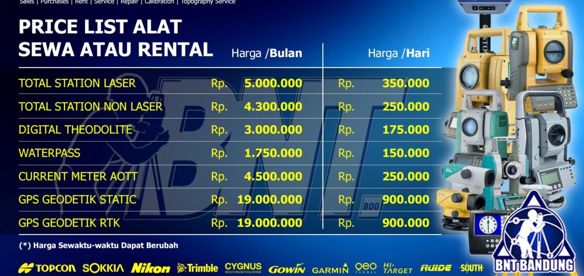
Kami CV.BNT menawarkan jasa rental atau sewa alat survey call/Whatsapp (0812-2222-9059) Seperti sewa GPS, RTK, TS, DT, WP, dengan durasi per hari rental per minggu sampai per bulan dengan harga terjangkau. Tidak hanya untuk di bandung tapi Melayani untuk seluruh indonesia dan meliputi kota kota seperti  , tangerang, bekasi, depok, bogor, karawang, subang, garut, tasikmalaya, cirebon, semarang, Yogyakarta, Jakarta, Malang, Surabaya, dan kota kota lainnya di pulau jawa. Bahkan melayani luar pulau jawa seperti lampung, palembang, medan, balikpapan, samarinda, palangkaraya, banjarmasin, makasar, manado, bali, lombok,  sampai papua.

Kelengkapan penyewaan alat instrument:
1. Set alat instrument include package
2. Aksesoris tambahan alat instrument

Anime fitness babes hentai movies masteron it reopens! opening video – palestra dimagrimondo fitness arena
[table id=1 /]


Harus Tau

buat sahabat survey yang tidak tahu apa kelebihan Sewa Rental GPS RTK/GPS GEODETIK  di CV.BNT kami berikan alasannya kenapa kalian harus SEWA di CV.BNT :

  1.  Alat berkualitas
  2.  Melawati QC Standar untuk rental/sewa
  3.  Toko milik sendiri jelas dan berlegalitas.
  4.  Siap Melayani Rental/Sewa seluruh indonesia.
  5.  Free pelatihan dasar Sebelum Rental (syarat ketentuan berlaku).
  6.  Free Konsultasi jika terjadi Trouble dilapangan
  7.  Jika alat bermasalah siap ganti alat Free ongkir (ditanggung CV.BNT)
  8.  Free Konsultasi alat Total Station yang cocok untuk proyek kalian sedang kerjakan.
    dan yang paling penting CV.BNT sudah MOU dengan beberapa BUMN dan Dinas.
PRODUK LAINNYA : Sewa alat survey, sewa total station 

DISCONTINUE

DIGITAL THEODOLITE NIKON NE 100

SPESIFICATIONS DIGITAL THEODOLITE NIKON NE-100

  • Accurate, affordable, easy to use
  • Ergonomic keypad
  • One-touch function keys
  • Large, backlit LCD display
  • NE-100/101 models are water-resistant
  • 5″, 7″ and 10″ accuracies available
  • Designed for general construction and survey applications,
  • Nikon NE-100 Series electronic digital theodolites give you accurate measurements in an affordable,
  • Easy-to-use platform.
  • Each of the four models has an ergonomic keypad with one-touch keys for all functions,
  • A large backlit LCD display helps you work productively in the field.


SUDAH TERMASUK AKSESORIS KOMPLIT STANDAR

  • 1x RAMBU UKUR
  • 1x TRIPOD/STATIF

Note:
*Harga Dapat Berubah Sewaktu – waktu tanpa pemberitahuan terlebih dahulu.
*Mohon tanya ketersediaan barang terlebih dahulu.