Results for "total station"

GPS Geodetik RTK GNSS Stonex S10

Spesifikasi Dan Fitur Gps Geodetik Stonex S10 GNSS Receiver RTK

Deskripsi:

The New Generation GNSS Receiver
Stonex S10, the most advanced integrated GNSS Receiver ever appeared on the geomatic scene, leads to a new generation of smart and open GPS, where the User has the ability to install customized applications directly on the receiver.

The advanced features of Stonesx S10, such as automatic leveling with electronic bubble, make surveying much faster and accurate.

The sophisticated internal structure design guarantees a compact housing: GNSS antenna, GPS board, power board, RX/TX radio, smart battery, 3.5G module, BT module and Wi-Fi module all take place in a well organized space, optimizing performances and power consumption.

Stonex S10 is based on CORTEX-A8 platform with on board LINUX smart system combined with an excellent networking system. With the provision of a special SDK package it is possible to develop and install special applications that run inside S10 ecosystem, enabling an unlimited range of advanced applications.

Fitur:

  • MULTI CONSTELLATION Stonex S10 with its 220 channels, provides an excellent on board real time navigation solution with high accuracy. All GNSS signals (GPS, GLONASS, BEIDOU and GALILEO) are included, no additional cost.
  • WEB UI CONTROL To initialize, manage, monitor the settings of the receiver and to download data using portable or PC, smartphone or tablet.
  • TILT CENTERING Its possible to measure points with inclination up to 30. The tilt compensator installed inside can automatically correct the coordinates of the points collected in accordance with the tilt angle and tilt direction of the range pole.
  • TWO INTELLIGENT BATTERIES Stonex S10 is delivered with two high capacity smart batteries. The power level can be checked from the controller and directly from a simple led bar on the battery by the simple press of a button.
  • RUGGED DESIGN IP67 PROTECTION IP67 certification, combined with a high shock resistance guarantee the maximum strength and the best water and dust tight even in harsh environments.


GPS Geodetik RTK GNSS Stonex S8

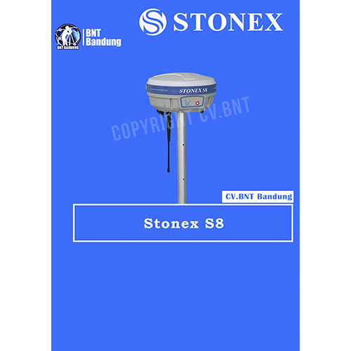
Spesifikasi Dan Fitur Gps Geodetik Stonex S8 GNSS Receivers RTK

The New Generation GNSS Receiver
Stonex S10, the most advanced integrated GNSS Receiver ever appeared on the geomatic scene, leads to a new generation of smart and open GPS, where the User has the ability to install customized applications directly on the receiver.

The advanced features of Stonesx S10, such as automatic leveling with electronic bubble, make surveying much faster and accurate.

The sophisticated internal structure design guarantees a compact housing: GNSS antenna, GPS board, power board, RX/TX radio, smart battery, 3.5G module, BT module and Wi-Fi module all take place in a well organized space, optimizing performances and power consumption.

Stonex S10 is based on CORTEX-A8 platform with on board LINUX smart system combined with an excellent networking system. With the provision of a special SDK package it is possible to develop and install special applications that run inside S10 ecosystem, enabling an unlimited range of advanced applications.

Fitur:

  • MULTI CONSTELLATION Stonex S10 with its 220 channels, provides an excellent on board real time navigation solution with high accuracy. All GNSS signals (GPS, GLONASS, BEIDOU and GALILEO) are included, no additional cost.
  • WEB UI CONTROL To initialize, manage, monitor the settings of the receiver and to download data using portable or PC, smartphone or tablet.
  • TILT CENTERING Its possible to measure points with inclination up to 30. The tilt compensator installed inside can automatically correct the coordinates of the points collected in accordance with the tilt angle and tilt direction of the range pole.
  • TWO INTELLIGENT BATTERIES Stonex S10 is delivered with two high capacity smart batteries. The power level can be checked from the controller and directly from a simple led bar on the battery by the simple press of a button.
  • RUGGED DESIGN IP67 PROTECTION IP67 certification, combined with a high shock resistance guarantee the maximum strength and the best water and dust tight even in harsh environments.

Note:
*Harga Dapat Berubah Sewaktu – waktu tanpa pemberitahuan terlebih dahulu.
*Mohon tanya ketersediaan barang terlebih dahulu.


 

GPS Geodetik RTK GNSS Spectra SP80 

The SP80 is a new generation GNSS receiver. SP80 uses the unique Z-Blade technology to track and process all available GNSS signals, to provide the most reliable measurements and the highest possible accuracies in challenging environments.

It also offers the best communications and connectivity capabilities available today including SMS and email alerts and anti-theft protection. The ergonomic design and unlimited operating time make the SP80 an extremely versatile and complete solution.

The SP80 GNSS receiver is a powerful, rugged and easy-to-use system designed for everyday surveyors. The SP80’s Z-Blade GNSS-centric technology delivers fast and reliable GNSS positioning utilizing all available GNSS signals to produce the optimal solution even in challenging environments. GPS-only, GLONASS-only or BeiDou-only positioning modes are available when necessary.

Unique communication technologies keep the surveyor connected. Web UI access via WiFi and SMSs can be used to monitor and configure the receiver. RTK bridge can save you money as network corrections can be relayed via radio to any rover in the survey job area.

Anti-theft technology protects your investment by sending emails and SMSs to alert users as well as making the receiver unusable if the SP80 base has been moved.


Key features :

Sangat skalabel dan serbaguna

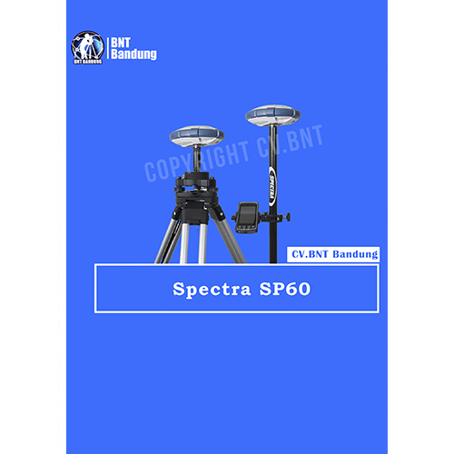
Sangat skalabel dan serbaguna, SP60 dapat merespons segala jenis pekerjaan survei, mulai dengan solusi post-processing L1 GPS saja, hingga dual-frekuensi jaringan GNSS RTK . Juga, antena GNSS yang mampu menangkap L-band, memberikan posisi CenterPoint RTX di tempat-tempat di mana jaringan RTK tidak tersedia. Dengan adanya, radio transmisi UHF atau Bluetooth Jarak Jauh yang tertanam memungkinkan receiver SP60 untuk dapat digunakan pada segala medan.

New 240-channel 6G ASIC

Spectra Precision SP60 dapat menangkap 240-channel 6G ASIC sepenuhnya menggunakan semua 6 sistem GNSS: GPS, GLONASS, BeiDou, Galileo, QZSS dan SBAS. Kemampuan unik GNSS-centric secara optimal menggabungkan sinyal GNSS tanpa ketergantungan pada sistem GNSS tertentu; ini memungkinkan SP60 untuk beroperasi dalam mode GPS-only, only-GLONASS atau BeiDou-saja jika diperlukan. Berkat teknologi GNSS yang unik ini, SP60 dioptimalkan untuk melacak dan memproses sinyal bahkan di lokasi yang ekstrim.

Center Point RTX capable rover

Layanan CenterPoint RTX yang dikirimkan melalui satelit adalah layanan koreksi yang dikirmikan oleh satelit pengkoreksi yang paling akurat. Layanan ini tidak memerlukan Base Station RTK atau jaringan seluler. SP60 yang disertai dengan antena GNSS L-band, yang merupakan kemampuan CenterPoint RTX, sangat ideal untuk beroperasi di area di mana tidak ada jaringan yang tersedia , tanpa harus ada  pengaturan base dan rover lokal. Diaktifkan untuk menerima koreksi CenterPoint RTX yang dikirim melalui satelit, SP60 dapat memberikan posisi kurang dari 4 cm dalam waktu 30 menit atau kurang. Berkat teknologi CenterPoint RTX dan jangkauan satelit, penerima SP60 GNSS dapat memberikan posisi dengan akurasi tinggi di mana pun di dunia.

Long Range Bluetooth

SP60 mengintegrasikan kemampuan Long Range Bluetooth yang kuat, memungkinkan  mode pengoperasian baru untuk surveyor. Sekarang, komunikasi nirkabel Bluetooth dapat digunakan sebagai penghubung alternatif antara base dan rover selain radio dengan jangkauan sejauh beberapa ratus meter menjadikan solusi ini sangat menarik untuk survei daerah yang kecil. Lebih mudah dan lebih sederhana daripada radio UHF, dan tanpa perlu lisensi, ini bisa menjadi cara yang sangat efisien untuk dengan cepat mengatur solusi base dan rover jarak dekat.

Anti-theft protection

Teknologi anti-pencurian mengamankan SP60 saat dipasang sebagai Base Station di lapangan di tempat-tempat terpencil atau tempat umum dan dapat mendeteksi jika produk terganggu, dipindahkan atau dicuri. Teknologi ini memungkinkan surveyor untuk mengunci perangkat ke lokasi tertentu dan membuatnya tidak dapat digunakan jika perangkat dipindahkan ke tempat lain. Dalam hal ini, SP60 akan menghasilkan peringatan audio dan memblokir perangkat dari penggunaan lebih lanjut. Teknologi anti-pencurian SP60 memberi para surveyor keamanan yang aman dan ketenangan pikiran.

Desain canggih

Selain antena GNSS L-band yang canggih, dan modul Long Range Bluetooth yang unik, desain receiver SP60 GNSS menggabungkan sejumlah ide dan perangkat tambahan yang inovatif. Ini fitur Case yang kokoh, tahan benturan, tahan terjatuh dari pole 2 m. Tahan air dengan standar IP67, dapat menangani kondisi luar yang paling sulit. Antena UHF yang dipasang di dalam batang fiberglass, memperluas jangkauan kinerja radio RTK dan memberikan perlindungan pada saat yang sama. Semua peningkatan ini membuat desain receiver GNSS SP60 benar-benar unik dan kuat.

Spesifikasi

  • 240 GNSS channels
    GPS L1C/A, L1P(Y), L2P(Y), L2C, L1C
    GLONASS L1C/A, L2C/A, L1P, L2P
    QZSS L1C/A, L2C, L1Z, L1C
    BeiDou B1, B2, B1C
    Galileo E1, E5b
    SBAS L1C/A
    L-band MSS
  • Support for Trimble RTX™ real-time correction services
  • Patented Z-Blade technology for optimal GNSS performance
    Full utilization of signals from all 6 GNSS systems
    (GPS, GLONASS, BeiDou, Galileo, QZSS and SBAS)
    Enhanced GNSS-centric algorithm: fully-independent
    GNSS signal tracking and optimal data processing,
    including GPS-only, GLONASS-only or BeiDou-only solution (autonomous to full RTK)
    Fast Search engine for quick acquisition and re-acquisition of GNSS signals
  • Patented SBAS ranging for using SBAS code & carrier observations and orbits in RTK processing
  • Patented Strobe™ Correlator for reduced GNSS multi-path
  • Up to 10 Hz real-time raw data
    (code & carrier and position output)
  • Supported data formats: ATOM, CMR, CMR+, RTCM 2.1, 2.3,3.0, 3.1 and 3.2 (including MSM), CMRx and sCMRx (rover only)
  • NMEA 0183 messages output
  • Weight
    0.93 Kg
  • Operation
     RTK rover & base
    RTK network rover: VRS, FKP, MAC
    NTRIP, Direct IP
    Post-processing
    Trimble RTX (satellite and cellular/IP)
  • GIS accuracy modes
    30/30
    Horizontal: 30 cm
    Vertical: 30 cm
    7/2 (firmware option needed)
    Horizontal: 7 cm
    Vertical: 2 cm

Note:
*Harga Dapat Berubah Sewaktu – waktu tanpa pemberitahuan terlebih dahulu.
*Mohon tanya ketersediaan barang terlebih dahulu.
GPS Geodetik RTK GNSS Spectra 120 L1

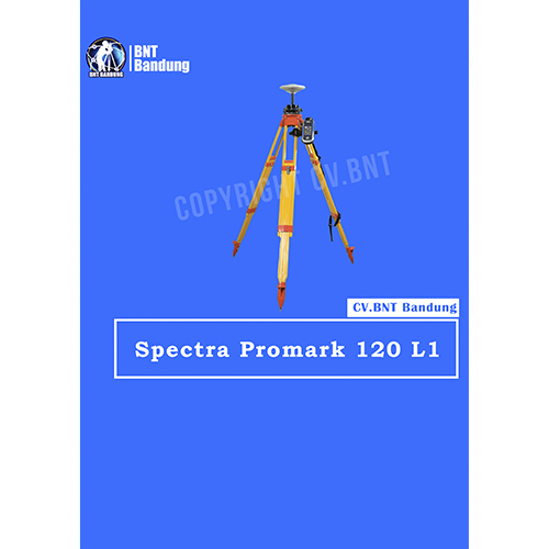
Spesifikasi Dan Fitur Gps Geodetik Spectra Precision ProMark 120 L1 Gps Static

ProMark 120 L1 GPS (Harga untuk barang NON GLONASS)
The Spectra Precision ProMark 120 GNSS system is the most versatile post-processing solution, designed for easy and efficient land survey applications. Thanks to the embedded Ashtech Z-Blade technology as well as GPS and GLONASS signals tracking, ProMark 120 provides high-precision measurements even in very demanding or obstructed environments.

GPS Geodetik RTK GNSS South S66oP

  • SOUTH terus kembangkan dan optimalkan produk yang inovatif
  • Jaringan RTK Receiver mengadopsi cerdas
  • platform cloud sebagai mesin barunya, untuk memimpin
  • pengembangan atau sistem RTK jaringan cerdas.

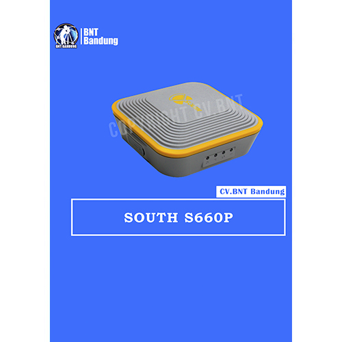
Menurut tren survei RTK saat ini, WiFi adalah teknologi baru dan berguna untuk pengukuran RTK yang membuat penggunaan penerima GNSS efektif, yang sangat meningkatkan efisiensi kerja dan fleksibilitas.WiFi S660P tidak hanya dapat menjadi hotspot wifi yang memungkinkan pengguna untuk menghubungkannya dan akses ke manajemen UI web S660P, tetapi juga dapat bekerja sebagai datalink yang membuat S660P memiliki koneksi cepat ke internet untuk koreksi dari jaringan CORS.

Kemampuan perlindungan yang luar biasa

  • Unit ini dibangun dengan bahan magnesium alloy untuk memastikannya dapat bekerja dalam kondisi yang sangat keras seperti hujan lebat, dan cincin karet dapat melindungi instrumen dari jatuh ke beton.
  • Dukungan konstelasi satelit penuh
  • Dilengkapi dengan papan GNSS paling canggih, 220 saluran dan performa pelacakan multi-konstelasi GNSS yang tak tertandingi, SOUTH S660P mampu melacak sebagian besar sinyal dari semua jenis konstelasi satelit yang sedang berjalan. Dan perangkat kompak ini memiliki kemampuan mengaktifkan atau menonaktifkan pelacakan konstelasi.


Note:
*Harga Dapat Berubah Sewaktu – waktu tanpa pemberitahuan terlebih dahulu.
*Mohon tanya ketersediaan barang terlebih dahulu.