Results for "theodolite"

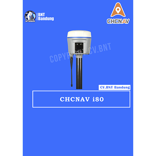
i80 represents the pinnacle of productivity on todays jobsite. Leading technology with superior capabilities, i80 is able to track all GNSS constellations: GPS, GLONASS, Galileo, BDS, QZSS and SBAS.
Key Features
220 channels multi-constellation receiver
128 64 dpi sunlight readable LCD panel
3.75G network modem
Internal TRx UHF
Built-in Bluetooth and WiFi communication
RTK data forwarding
Dual hot-swappable batteries
32 GB internal memory

Incorporated with dual hot-swappable batteries, i80 is capable of working continuously without interruption and considered the smartest GNSS receiver in the market. Integrated 3.75G network modem, Rx/Tx UHF module, E-bubble, Bluetooth and WiFi connectivity provide a seamless solution in the field.

High-resolution LCD panel also exploits new method for surveyors to check the working states of a receiver. All these features integrated into a small but ruggedized package can help to achieve the most productive day of surveying possible.

CHC continues to build on its reputation for reliability. i80 is constructed of cast magnesium chassis with double sealed gaskets, protected connectors, and vibration dampened internal parts. This contributes to the outstanding field survivability of IP67, the ability to resist 2 m pole fall onto concrete and high vibration environment.
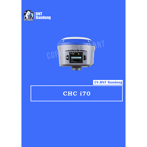
Fitur Gps Geodetik CHC i70

  • 220 Channel Full GNSS
  • Internal 3.75G Network Modem
  • Rugged Disegn Readable LCD Panel
  • Integrated UHF Modem
  • Waterproof and Strong
  • Huge Storage
  • High Precision
  • Waterproof : IP67
  • Weight : 1,1 kg
  • Battery Capacity : 3200 mAh x2
  • Operating Times : 6 hours

Spesifikasi Gps Geodetik CHC i70

  • Saluran : 220 Channel
  • GPS : L1 C/A, L1C, L2C, L2E, L5
  • GLONASS : L1 C/A, L1P, L2 C/A, L2P, L3
  • SBAS : WAAS, EGNOS, MSAS
  • Galileo : E1, E5a, E5b (Test)
  • BeiDou : B1, B2
  • Advanced Multipath Mitigation
  • Low Noise Carrier Phase Measuremen

Real Time Kinematic :

  • Horizontal 8 mm + 1 ppm RMS Vertikal 15 mm + 1 ppm RM
  • Initialization Time : Typically < 10 Seconds
  • Initialization Reliability : Typically > 99.9 %

Post Processing Static :

  • Horizontal : 33 mm + 0.1 ppm RM
  • Vertikal : 5 mm + 0.4 ppm RMS

Code Differential Accurasy :

  • Horizontal : 25 CM +1 ppm RMS
  • Vertikal : 40 CM+1 ppm RMS
  • Bluetooth, NFC : x1
  • Integrated 3,75G Modem, Sim Card Slot : x1
  • DC Power Input USB Datab Download (7pins) : x1
  • TNC Antenna Connector : x1
  • DC Power Input and Data Output Port (7pins) : x1
  • CHC Internal UHF Radio (Standard) :
  • 410 – 470 Mhz, Work distance 5KM
  • Protocol : CHC, Trimble, Pacific crest
  • Transmit Power : 0,5W to 2W

Data Protocol :

  • RTCM2.1, RTCM2.3, RTCM3.0
  • CRM, CMR+ and SCMRX input and Output
  • NMEA0183 Outputs
  • Rinex and HCN Outputs for GNSS raw Data

Data Storage :

  • 32GB Internal Memory + 8GB Internal Micro Storage Card
  • Record HCN and RINEX Format Simultaneously

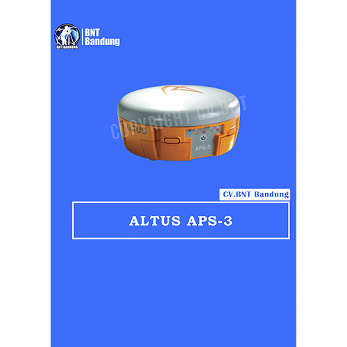
Altus APS-3 RTK GPS GLONASS APS-3 :

  • 136 Channel GPS + GLONASS receiver
  • Integrated Quad-Band GSM/ GPRS Modem or CDMA Modem
  • Integrated Digital UHF transceiver, 406-470 MHz
  • Integrated Bluetooth
  • Dual Hot-Swap Li-Ion Batteries with Fuel Gauge
  • Removable min.2 GB SD Card storage

With Altus s open architecture philosophy, the user has the choice of data collector software from MicroSurvey FIELDGenius or Carlson SurvCE to custom field computers are used to communicate with the APS-3 via Bluetooth for a cable free operation.

Furthermore, the APS-3 houses two hot swappable Li-lon batteries for continuous operation. Re-charging is done within a few hours with the included charger.

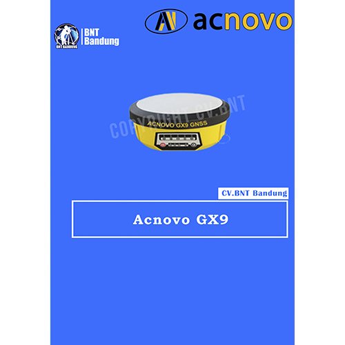
Fitur Gps Geodetik Acnovo Gx9

  • Chip GNSS Trimble BD970
  • Saluran 220
  • GPS, KOMPAS, GLONAS, SBAS, GALILEO
  • 1 cm + 1 PPM RTK akurasi
  • 3 mm 1patic Akurasi
  • Koneksi internal 0,5 / 2W
  • Diupgrade ke 35W
  • NTRIP GSM / GPRS 70 Kilometer
  • Memori internal 256 MB / expandible 32 GB (micro SD)
  • Bluetooth Komunikasi 2.0
  • Sertifikasi IP67
  • Melawan kondisi yang paling menuntut

Spesifikasi Gps Geodetik Acnovo Gx9

  • Chip GNSS Trimble BD970
  • Channels 220
  • Traceable signals
  • Ketepatan dalam rencana (statika) ± 3 + 0,5 * 10-6 * D
  • Ketepatan tinggi (statika) ± 3 + 0,5 * 10-6 * D (di mana D adalah jarak yang diukur dalam mm)
  • Rentang pekerjaan dalam statis hingga 100 km
  • Akurasi dalam hal (RTK) ± 8 + 1 * 10-6 * D
  • Ketepatan ketinggian (RTK) ± 15 + 1 * 10-6 * D (di mana D adalah jarak yang diukur dalam mm)
  • Jangkauan pekerjaan di RTK hingga 80 km
  • Akurasi DGPS 0,45m (RMS)
  • Mode offline 1.5m (RMS)
  • Akurasi SBAS 1m
  • GPS L1 C / A Simultan, L2E, L2C, L5
  • GLONASS L1 C / A Simultan, L1P, L2 C / A (Solo GLONASS M), L2P
  • SBAS L1 C / A Simultan, L5
  • GIOVE-A (Galileo) Simultan L1 BOC, E5A, E5B, E5AltBOC1
  • GIOVE-B (Galileo) L1 CBOC, E5A, E5B, E5AltBOC1 Simultan
  • KOMPAS B1 (QPSK), B1-MBOC (6.1, 1/11), B1-2 (QPSK), B2 (QPSK), B2-BOC (10.5), B3 (QPSK), B3BOC (15.2, 5), L5 (QPSK)
  • Rentang aksi Hingga 3-5 km dalam pengembangan kota, Hingga 5-8 km di lapangan
  • Interval akuisisi 1-15 dtk
  • Waktu inisialisasi 15 detik
  • Sinyal inisialisasi RTK Biasanya 10 detik
  • Perbarui frekuensi hingga 50 Hz
  • Rebut kembali sinyal 1 s
  • Memori Built-in 256MB / Diperluas hingga 32GB (microSD)
  • Rentang frekuensi 410-470MHz
  • Lebar saluran 12.5KHz • Daya 0,5 / 2V

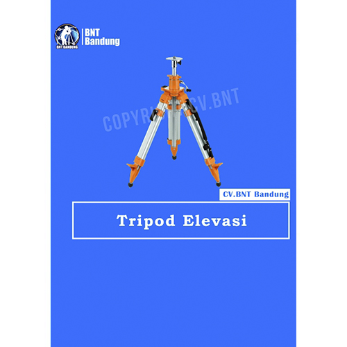
Tripod survey elevasi berkualitas tinggi yang kokoh dan stabil untuk mendukung pengukuran akurat menggunakan total station maupun GPS RTK. Mudah diatur, kuat, dan tahan untuk penggunaan lapangan.

Ready Stock

  • Tripod Elevasi Lokal
  • Kualitas dijamin bagus
  • levasi 180cm up to 230cm

Hubungi WA/Call 081222229059

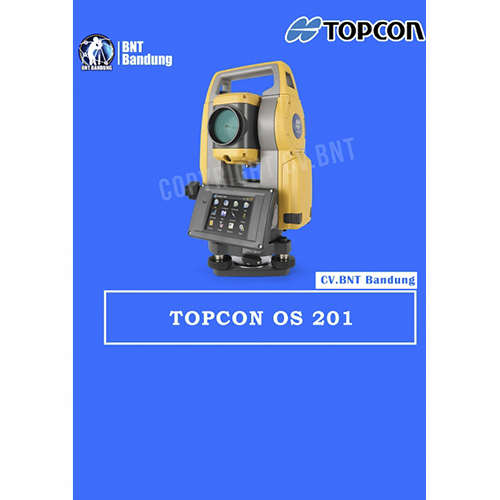
Total Station Topcon OS 201

Unconventional reflectorless technology PLUS MAGNET™ software
The OS is a professional, compact total station that features an all-new design and on-board data collection interface.
With Topcon’s exclusive long range Long Link TM wireless communication, plus an incredibly powerful EDM, the new OS Series offers unmatched performance for a wide range of tasks, such as:

  • Land Surveying – property, topo ,stakeout
  • Earthwork volumes
  • Interior layouts
  • Road construction
  • Mapping for law enforcement/ Forensics
  • Mining

Accurately survey dark and wet surfaces such as coal mining applications, bitumen roads and wet pavements with 500 m reflectorless range.
Features:

  • Advanced Security & Maintenance with New TSshield™ for software updates and tracking if your instrument is lost or stolen
  • MAGNET Field On-board
  • Exclusive LongLink™ Communications Functionality – reduce errors by staying at the pole without the need to use radios!
  • Narrow beam ideal for measuring corners, cables and surveying through fences
  • Fast and Powerful EDM (0.9 seconds)
  • Convenient EDM trigger key with minimal disturbance
  • Advanced Angle Accuracy
  • Available in 1, 2, 3 and 5 arc second accuracy models

MAGNET™ Field on-board software

MAGNET Field runs directly on the OS total station touch screen. Plug in a USB flash drive into the side panel for quick, easy file transfer, or use a USB mini cable to connect to your computer.

With direct exchange between MAGNET Field On-board and MAGNET Office Tools, you can transfer data more efficiently and increase your productivity.
All of the total station functions are available directly on-board.
In Survey, there is: Topo, X-Section, Find Station, Tape Dimension, and Missing Line. In Stake, access Points, Lines, Offsets, Surface, Point in Direction, Curve, Real-Time Roads, Road, Slope, and Linework staking. There are also numerous calculation functions like Inverse, Intersection, Curves, Area, Corner Angle, Offsets, Adjust, Traverse, and DTM.
Untuk Spesifikasi lengkap bisa download disini.


SUDAH TERMASUK AKSESORIS KOMPLIT STANDAR

  • 1x PRISMA AK
  • 1x PRISMA ADS
  • 1x POLE
  • 2x TRIPOD

Note:
*Harga Dapat Berubah Sewaktu-waktu tanpa pemberitahuan terlebih dahulu.
*Mohon tanya ketersediaan barang terlebih dahulu.