Results for "hi target"

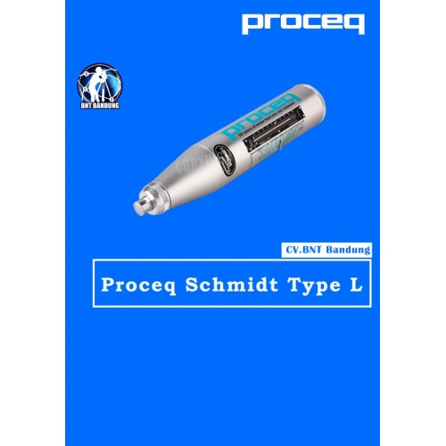
Deskripsi Proceq Original Schmidt Type L – Concrete Hammer Test
Proceq Original Schmidt Type L

DIFFERENCE Type N & L:
* Type N: Standard impact energy. Minimum thickness of test object: 100 mm (3.9”’) and should be firmly fixed in the structure
* Type L: Low impact energy. Suitable for brittle objects or structures less than 100 mm (3.9”’) thick

OVERVIEW:
The original Schmidt hammer, type L is the ideal option for testing thin walled items with a thickness between 50 to 100 mm (2”” and 4”’) or for analyzing small components. It is also suitable for examining cast stone components which are sensitive to impact. In rock mechanics, the type L Original Schmidt is commonly used for the classification of rock cores and brittle rock.

The Type L Hammer is a portable and relatively inexpensive nstrument for measuring the surface hardness of rock. The hammer can be used efficiently in both the laboratory and the field.

The mechanism of operation is simple: a hammer released by a spring, indirectly impacts against the rock surface through a plunger and the rebound distance of the hammer is then read directly from the scale ranging from 10 to 70 MPa (1,450 to 10,152 psi).

The type L hammer is used on NX or larger core specimens or block specimens having an edge length of at least 6 cm. TC-3040 Calibration Anvil, manufactured from a special steel alloy, is used for the calibration of test hammers.
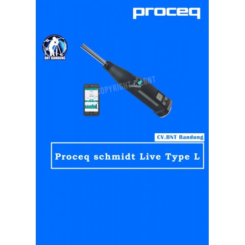
HAMMER TEST PROCEQ SCHMIDT LIVE TYPE L

Proceq Original Schmidt Live Type L

DIFFERENCE Type N & L:
* Type N: Standard impact energy. Minimum thickness of test object: 100 mm (3.9) and should be firmly fixed in the structure
* Type L: Low impact energy. Suitable for brittle objects or structures less than 100 mm (3.9) thick

OVERVIEW:
The Original Schmidt Live is a uniquely versatile hammer that can be used as stand-alone analog hammer, a stand-alone digital hammer, together with a Bluetooth printer and finally as the worlds most advanced R-value concrete test hammer with the Schmidt Live app

KEY FEATURES:
* Comprehensive Apple iOS app for measuring, reporting and analysis
* Web reporting tool for instant offsite data availability and synchronizing
* Light and strong fiber-reinforced shell
* Powered by flight-safe AAA batteries
* Dual displays: analog and backlit digital
* All mechanical components are Original Schmidt components to ensure standards compatibility and durability

MEASUREMENTS:
* Automatically detects and corrects for impact angle
* Displays the series on-screen as you work
* Series validity checked automatically
* Review an entire series
* Delete impacts
* Test regions
* Select units, form factor and correlation curves
* Create your own custom curves
* Create custom curves databases for your own mixes

WITH Apple iOS app, you can:
* Allows you to test in accordance with major standards
* Visual reports are generated using lists, bar charts, and statistics
* Records data from the app to a web reporting tool
* Report export options of PDF or CSV
* Records GPS locations, enables adding notes, images and audio comments using the Logbook feature for full measurement activity traceability. Logbook feature for full measurement activity summaries
* Hammer verification management to help keep hammers calibrated as required by standards
* Impact results can be heard live in audio on Apple iOS devices via text-to-speech

GPS  RTK Foif N90 GNSS

Foif N90 didukung oleh multi-GNSS dengan 555 channels tracking yang mampu melacak sinyal satelit dengan cepat dan menghasilkan hasil kinerja yang unggul. Designnya sendiri dilengkapi teknologi canggih seperti IP67 yang mampu menahan air, debu hingga gonacangan goncangan yang terjadi di lapangan. Sehingga, para surveyor tidak perlu khawatir lagi jika kondisi dan cuaca kurang mendukung untuk kegiatan surveying. FOIF N90 dilengkapi memori internal dengan kapasitas sebesar 8gb juga mensupport memori external sd card 32 gb. Hal ini akan sangat membantu para surveyor dalam mengumpulkan data. Selain itu, dengan adanya fitur Wifi, GSM, Bluetooth dan Antena dapat mempermudah surveyor dalam mengunduh dan mentransfer data dari/ke hp hingga komputer, tidak perlu kabel dan tidak ribet. FOIF N90 ini sangat recommended untuk para surveyor yang akan memulai proyekan. Akan sangat mempermudah pekerjaan surveying dan menjadikan produktifitas lebih simple, praktis dan efektif.

SPESIFIKASI FOIF N90

RTK SYSTEM

  • GNSS Singal Track 220 channels
  • GPS L1,C/A,L2E, L2C, L5
  • GLONASS L1,C/A,L1P, L2,C/A ,L2P,L5;
  • BDS B1 B2 B3
  • SBAS(WAAS,MSAS,ENGOS)L1,C/A,L5;
  • GLOVE-AB L1 BOC(CBOC)-E5A/B, E5AltBOC
  • RTCM2.3, RTCM3.X, RTCM3.2, CMR, CMR+

RECEIVER ACCURACY

  • Static post processing accuracy H:2.5mm+110 D;V:5.0mm+110 D
  • RTK Positiong accuracy H: 8mm+110 D; V:15mm+110 D
  • Code different positioning accuracy 0.45m
  • Single point positioning 1.5m

DATA LINK

  • TX/RX Radio Internal radio RX/TX 5KM-10KM
  • External radio FOIF external radio Rx & Tx(FDL-5, 2/35W selectable)
  • WIFI co

GPS Base and Rover Kits with 555 Channels (N90)

  • Professional GNSS RTK GPS Satellite tracking GPS, GLONASS, GALILEO, and Beidou
  • Equipped with industry standard GNSS engine
  • Voice messages
  • LED display with superior brightness & temperature range
  • Base and rover communication options to suit any application
  • FOIF PRS (Portable Reference System) technology, compatible with other brands GNSS products
  • 3.5 G WWAN (HSDPA/WCDMA/EDGE…) module option
  • When the pole is tilted in ±30 degree, the A30 still could get the right point data by automatic correct system
  • Automatic data collection during centering FOR RTK GPS APPLICATION
  • N90 GPS RTK SYSTEM include base station, and rover station, tripod is not a standard accessories, most cost – effective gps rtk unit with competitive price


Note:
*Harga Dapat Berubah Sewaktu – waktu tanpa pemberitahuan terlebih dahulu.
*Mohon tanya ketersediaan barang terlebih dahulu.


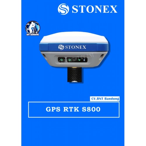
GPS Geodetik RTK GNSS Stonex S800

GPS Stonex S800 mampu melakukan pelacakan melalui berbagai macam GNSS seperti GPS, GLONASS, Galileo, BeiDou, IRNSS, dan QZSS dengan dukungan 555 channels. Melalui keunggulan pelacakan menggunakan berbagai GNSS lah yang menjadikan GPS S800 mampu memberikan hasil kinerja yang sangat akurat. Designnya sendiri dibuat praktis dengan dilapisi IP67 yang mampu menahan debu, air dan goncangan sekalipun. Pastinya GPS S800 sangatlah kuat dan kukuh jika dibawa ke medan yang cukup kasar, sangat recommended.

Dengan teknologi canggih E-Bubble, GPS S800 dapat langsung menampilkan tiang vertikal dan titik yang terekam otomatis pada perangkat lunaknya saat tiang diratakan. Hal ini memungkinkan untuk menghitung titik dalam kemiringan >30 dereajat. GPS S800 pun memiliki teknologi canggih lainnya seperti radio internal 10-470MHz dan 902,4-928MHz, modem gsm 4G dengan internet yang sangat cepat dan juga Wi-Fi yang akan membantu para surveyor dalam mengunduh dan mentransfer data dari / ke hp, tablet, laptop dan komputer. Kapasitas dan daya tahan baterai yang diberikan pun terbilang cukup lama untuk menemani surveyor dalam kegiatan surveying seharian, yaitu 5200mAh yang mampu bertahan selama 10 jam. Surveyor tidak perlu khawatir, karena baterai ini sifatnya rechargeable alias dapat diisi ulang yang hanya memakan waktu 4 jam.

SPESIFIKASI GPS STONEX S800:

  • Channels: 555
  • GPS: L1C/A, L1C, L2P, L2C, L5
  • GLONASS: L1C/A, L2C, L2P, L3, L5
  • BeiDou: B1, B2, B3
  • Galileo: E1, E5 AltBOC, E5a, E5b, E6
  • QZSS: L1C/A, L1C, L2C, L5, L6
  • SBAS: L1, L5
  • IRNSS: L5
  • Position Rate: 5 Hz, optional up to 20 Hz
  • Signal Reacquisition: < 1 sec
  • RTK Signal Initialization: Typically < 10 s
  • Hot Start: Typically < 15 s
  • Initialization Reliability: > 99.9 %
  • Internal Memory: 8 GB
  • Battery: Rechargeable 7.2 V-6800 mAh
  • Rechargeable 7.2 V-5200 mAh
  • Voltage: 9 to 18 V DC external power input with over-voltage protection (5 pins Lemo)
  • Working Time: 10 hours
  • Charge Time: Typically 4 hours
  • Weight: 1.2 Kg
  • Dimensions: 146 mm x 146 mm x 76 mm
  • Operating Temperature: -40 °C to 65 °C
  • Storage Temperature: -40 °C to 80 °C
  • Waterproof/Dustproof: IP67
  • Shock Resistance: Designed to endure to a 2m drop pole on concrete floor with no damage
  • Vibration: Vibration resistant


Note:
*Harga Dapat Berubah Sewaktu – waktu tanpa pemberitahuan terlebih dahulu.
*Mohon tanya ketersediaan barang terlebih dahulu.

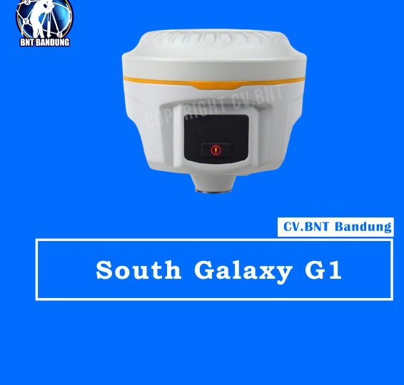
Spesifikasi South Galaxy G1

GNSS performance

  • Channels: 220(standard), 965(optional), 555(optional)
  • GPS: L1C/A, L1C, L2E, L2C, L5
  • GLONASS: L1C/A, L1P, L2C/A, L2P, L3
  • BDS: B1, B2, B3 (only with installing SOUTH and NovAtel board)
  • GALILEO: E1, E5a, E5b, Alt-BOC, E6
  • SBAS: L1 C/A, L5 | QZSS, WAAS, MSAS, EGNOS, GAGAN
  • L-Band: —
  • Positioning output rate: 1Hz, 2Hz, 5Hz, 10Hz, 20Hz & 50Hz (depends on installed option)
  • Initialization time: <10s
  • Initialization reliability: >99.99%

Positioning precision

  • Static surveying:
    • Horizontal: 2.5mm+0.5ppm;
    • Vertical: 5mm+0.5ppm
  • Code differential positioning:
    • Horizontal: 25cm+1ppm;
    • Vertical: 50cm+1ppm
  • Real-time kinematic surveying:
    • Horizontal: 8mm+1ppm;
    • Vertical: 15mm+1ppm
  • RTX: —
  • SBAS positioning: Typically<5m 3DRMS

User interaction

  • Operaing system: Linux
  • Buttons: Single button operation
  • LCD: —
  • Indicators: 3 indicate lights
  • Web UI: Freely to configure and monitor the receiver by accessing to the web server via Wi-Fi and USB

Hardware performance

  • Dimension: 129mm (Diameter) x 112mm (Height)
  • Weight: 1kg (battery included)
  • Material: Magnesium aluminum alloy shell
  • Operating temperature: -45°C ~ +60°C
  • Storag temperature: -55°C ~ +85°C
  • Humidity: 100% Non-condensing
  • Waterproof/Dustproof: IP68 standard,
  • Shock and vibration: Withstand 2 meters drop onto the cement
  • Power Supply: 9-25V DC
  • Battery: Lithium-ion battery, 7.4V 3400mAh/per
  • Battery: 4 standard batteries (optional)

Communications

  • I/O port: 5-PIN LEMO port, 7-PIN USB port (with OTG)
  • Wireless modem: Built-in radio, 1W/2W/3W switchable, typically work range can be 8KM
  • Frequency Range: 410-470MHz
  • Communication Protocol: TrimTalk, SOUTH
  • Cellular Mobile Network: TDD-LTE/FDD-LTE 4G network modem
  • Bluetooth: BLEBluetooth 4.0 standard

WIFI

  • Standard: 802.11 b/g standard
  • WIFI Hotspot

Purchase Package:

  • South Galaxy G1
  • Base
  • Rover
  • Controller
  • Farlink Radio 12 km
  • Garansi Resmi, DKI Jakarta Gratis Pelatihan


Note:
*Harga Dapat Berubah Sewaktu – waktu tanpa pemberitahuan terlebih dahulu.
*Mohon tanya ketersediaan barang terlebih dahulu.

GPS RTK GNSS Titan TR7

GPS Titan TR7 adalah GPS dengan multi GNSS yang berkualitas tinggi dari brand TITAN. GPS Titan TR7 dapat menerima 440 channels tracking dengan pelacakan yang sangat luar biasa akurat dengan radio multi-konstelasi dan multi-protokol yang berkompatible dengan berbagai merek/brand lainnya. GPS Titan TR7 sudah didukung dengan beberapa teknologi modern yang sangat canggih, salah satunya jaringan seluler berkoneksi 4G/3G/2G dan juga mendukung WiFi/BT4.0/NFC/OTG.

GPS Titan TR7 sudah dilengkapi pelindung IP67 yang membuat GPS Titan TR7 ini bisa tahan terhadap air, perendaman di air, goncangan-gonacangan, kejatuhan, hinga debu-debu di lapangan. Sudah terjamin bahwa GPS Titan TR7 tetap akan bisa digunakan disegala kondisi dan cuaca, pastinya tidak akan menghambat produktivitas para surveyor.  Baterainya sendiri berkapasitas 6800mAh yang mampu bertahan selama 10 jam, GPS Titan TR7 sangat cocok untuk membantu surveying seharian.

SPESIFIKASI GPS  TITAN TR7

MEASUREMENT PERFORMANCE

Initializing Time : Less Than 10 Seconds
RTK : Hz 8mm + 1 ppm / V 15mm + 1ppm RMS
Static : Hz 2.5 mm + 0.5ppm / V 5mm + 0.5ppm RMS
High Precision Static : Hz 2.5mm + 0.1ppm / V 3.5mm + 0.4ppm RMS
DGPS : Hz 0.25mm + 1ppm / V 0.5mm + 1ppm RMS
Initialization Reliability : 99.99%
Static Data Format : GNS and Rinex


Signal Tracking

GPS : L1 C/A, L2 C/A, L2P, L5
GLONASS : L1 C/A, L1P, L2 C/A, L2P
BeiDou : B1 B2 B3
Galileo : Reserved
Bands : 116 Bands


Communication Ports :
USB, TNC Antena Port and NANO Sim Card Slot 4G LTE Bluetooth 4.0
Wi-Fi and NFC
DC Eksternal Power Input
LED Indicator Panels


Internal UHF Transceiver :

Frequency : 403 – 473 MHz
Channel : 116 ( 16 Configurable )
Transmitting Power : 1W / 2W / 4W
Protocols : Hi-Target, Trimtalk 450s, Trimmark III, Transeot, Satel-3as
Working Range : 5-6 Km typical, 6-7 Km Optimal


SYSTEM

Star Up Time : 3 Seconds
Data Storage : 16 GB Internal Storage
Sensor : Electronic Bubble and Tilt Survey


DATA MANAGEMENT

Environmental :
IP67 Environmental Protection
Humidity 100% Condensing
Shock Resistant Body To 2m ( 6.5ft ) pole drop
Temperature : -40 Derajat to 75 Derajat Celcius Operating -55 Derajat to 85 Derajat Celcius Storage


Physical Properties :

OLED Screen : 1.54in
Resolution : 128 x 64
Size : 137 mm x 133 mm
Weight : 1.35kg Including Battery
Power : 6 – 28V DC Input
Battery : 6800 mAh Li-Ion Battery
battery : Life 10 Hours


Note:
*Harga Dapat Berubah Sewaktu – waktu tanpa pemberitahuan terlebih dahulu.
*Mohon tanya ketersediaan barang terlebih dahulu.