Results for "hi target"

GPS Geodetik RTK GNSS Horizon Cronos C3

HORIZON GPS GEODETIK KRONOS 300

The Kronos 300 is a GNSS receiver that allows you to do more, a HORIZON GNSS product which continues with the tradition of performance excellence shown by the Kronos 200 GNSS system. It now features a more robust and rugged housing, within which resides a faster and more powerful BD970 boardbuilt on the proven Maxwell 6 technology.

Like the Kronos 200, the Kronos 300 also features an in-built GSM/GPRS module, as well as an in-built UHF transmitter module for a complete communication interface. The UHF modulehas been upgraded to a power-switchable type, which would allow atransmission range of beyond 8 km independently.

Spesifikasi Horizon Kronos 300:
• 220 Channel
• GPS GLONNAS QZSS
• GALILEO SBAS Beidou
• L1 L2 L5
• Statik 3mm
• RTK 8mm
• Outsanding waterproof IP67


Spesifikasi Hemisphere S631

  • Channel Information
    Channels: 800+
    GPS: L1CA, L1P, L1C, L2P, L2C, L5
    BeiDou: B1i, B2i, B3i, B1OC, B2A, B2B, ACEBOC
    GLONASS: G1, G2, G3, P1, P2
    Galileo: E1BC, E5a, E5b, E6BC, ALTBOC
    QZSS: L1CA, L2C, L5, L1C, LEX
    IRNSS: L5
    Atlas Capable: Yes
  • Physical
    Size: 156 mm x 76 mm
    Weight: 1.19 kg (with one battery)
    1.30 kg (with two batteries)
    Input Voltage: 9 to 28 V DC
  • Environmental
    Operating Temperature: -30 °C ~ +65 °C
    Storage Temperature: -40 °C ~ +80 °C
    Protection: IP67
    Shock Resistance: MIL-STD-810G, method 516.6
    Humidity: Up to 100%
    Vibration: MIL-STD-810G, method 514.6E-I

Features

  • Multi-frequency GPS, GLONASS, BeiDou, Galileo, QZSS, IRNSS, and Atlas L-band
  • Long-range RTK baselines up to 50 km with fast acquisition times
  • UHF (400 MHz & 900 MHz), cellular, Bluetooth, and Wi-Fi wireless communication
  • Athena GNSS engine providing best-in-class RTK performance
  • Internal sensor corrects collected point coordinates to within 2 cm


Note:
*Harga Dapat Berubah Sewaktu – waktu tanpa pemberitahuan terlebih dahulu.
*Mohon tanya ketersediaan barang terlebih dahulu.

GPS Geodetik RTK GNSS Geomax Zenith 35

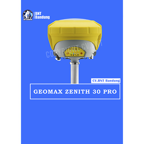
Spektrum penuh dari sinyal satelit, konektivitas penuh, dan fungsi Tilt & Go yang unik semuanya dalam GNSS yang ringkas menjadikan seri Zenith35 Pro GNSS yang berfungsi saat Anda melakukannya.

Sebuah sudut gedung atau bahkan selokan di bawah mobil yang diparkir? Fungsi Zenith35 Pro Tilt & Go yang unik memungkinkan Anda untuk mengukur titik di mana penempatan vertikal tiang tidak mungkin, seperti sudut-sudut rumah.


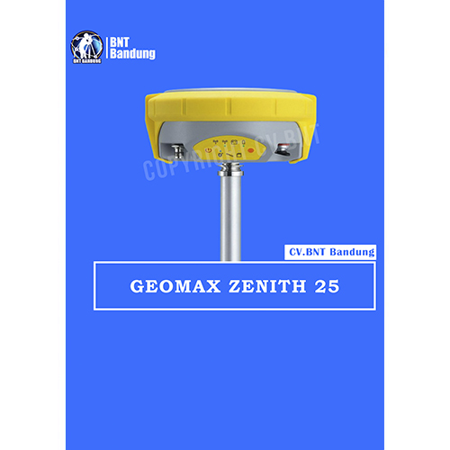
GeoMaz GNSS Zenith 25

  • Equipped with the most advanced GNSS receiver technology,
  • Zenith25 Pro series supports GPS, GLONASS, Galileo, BeiDou,
  • and SBAS systems. Suitable for any application, the Zenith25
  • Pro series additionally considers new GNSS constellations like BeiDou and Galileo today and is prepared for even more signals tomorrow.

*BeiDou tracking B1,B2

Galileo tracking E1, E5b
Positioning rate 20Hz*, 5Hz
SBAS EGNOS, WAAS, MSAS, GAGAN

ACCURACY
Static H/ V (mm + ppm) 3 + 0.5 / 5 + 0.5
Static long H/ V (mm + ppm) 3 + 0.1/ 3.5 + 0.4
Kinematic H/ V (mm + ppm) 8 + 1 / 15 + 1

**COMMUNICATION
GSM/GPRS module Quad-Band GSM & Penta-Band ; UMTS 800 /850 /900 /1900 /2100 MHz ;internal antenna
UHF radio module 000 mW transcei ver; 4 06480MHz
Bluetooth Device class II
Communication port USB, serial and power

**INTERFACES
Keyboard On/off and function keys
LED status and mode indicators Position, battery, Bluetooth
,RTK receive, RTK transmit, storage card ;
Rover, base, static

Data recording GSM / TCP / IP

GeoMax Zenith15 adalah receiver GNSS yang lengkap dan terintegrasi penuh, yang memungkinkan pelacakan sistem GPS dan GLONASS. Tersedia sebagai model GSM atau GSM-UHF Zenith 15 adalah pilihan ekonomis Anda.GeoMax Zenith15 adalah receiver GNSS yang lengkap dan terintegrasi penuh, yang memungkinkan pelacakan sistem GPS dan GLONASS. Tersedia sebagai model GSM atau GSM-UHF Zenith15 adalah pilihan ekonomis Anda.

The GeoMax Zenith15 is a complete and fully integrated GNSS receiver, allowing tracking GPS and GLONASS systems. Available as GSM or GSM-UHF model Zenith15 is your economic choice.

COMPACT

  • Integrated GSM antenna
  • Quick swappable SIM & microSD card
  • Complete control with receiver keypad
  • HIGH PERFORMANCE
  • NovAtel® technology
  • GPS, GLONASS & SBAS
  • GSM/GPRS, UHF radio & Bluetooth®

MIX & MATCH
Combine with your preferred datalogger and software
Open connectivity
Complete setup flexibility

Spesifikasi :
Q-Lock technology : Lowest noise and multipath mitigation
Satellites (Max. number tracked simultaneously) : 60
Channels : 120
GPS tracking : L1, L2, L2C
Glonass tracking : L1, L2
Positioning rate : 5Hz
SBAS : EGNOS, WAAS, MASAS, GAGAN

Accuracy
Static H/V (mm + ppm) : 5 + 0.5 / 10 + 0.5
Static long H/V (mm + ppm) : 3 + 04 / 3.5 + 0.4
Kinematic H/V (mm + ppm) : 10 + 1 / 20 + 1

Communication
GSM/GPRS module : Quad-Band GSM & Penta-Band; UMTS 800/850/ 900/ 1900/ 2100 Mhz; internal antenna
UHF radio module : 1000 mW transceiver, 406 – 480 MHz
Bluetooth : Device class II
Communication port : USB, serial and power

Power Supply
External power / Internal battery : 10.5 V to 28 v / Removable 2.6 Ah ; 74 V
Operating time (static/rover) : 7.5 h / 5 h

Interfaces
Keyboard : On/Off and function keys
LED status and mode indicators : Position, battery, Bluetooth, RTK transmit, storage card; Rover, base, static
Data recording : 8Gb removable microSD card
GSM / TCP / IP : Removable SIM card

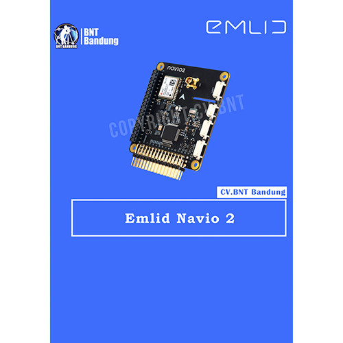
This is the Navio2 Autopliot Shield that is used with the Raspberry Pi board (sold separately). This autopilot is not only designed as a platform for a Linux version of APM but also as a platform for your custom robotic projects.

The Navio2 eliminates any need to have multiple controllers on-board as everything is packed into one (with the Raspberry Pi), thus increasing the robustness of your project and facilitating the development.

With the Navio2, you can control all kinds of moving robots such as cars, boats, multirotors and planes. The Navio2 is also equipped with double IMU and a GPS/Glonass/Beidou receiver for accurate positioning and orientation.

Navio is more than a ready to fly autopilot – it was built for research and education and has proven itself in universities and research institutions worldwide. Just think of the numerous projects that involve IMU, GPS, barometer, servo control and a user-friendly programming environment.

Open-source drivers and detailed tutorials are available both in C++ and Python. All experimental data can be processed directly on Raspberry Pi.