Results for "GPS RTK"

GPS RTK  Tersus Oscar Ultimate

Supports multiple constellations & frequencies
  • GPS L1C/A, L2C, L2P, L5
  • GLONASS L1C/A, L2C/A
  • BeiDou B1I, B2I, B2a, B3I
  • Galileo E1, E5a, E5b
  • QZSS L1C/A, L1C, L2C, L5
  • SBAS (EGNOS, WAAS, MSAS, GAGAN) L1C/A
Supports 576 channels
410-470MHz UHF radio, 4G network, Wi-Fi, Bluetooth, NFC
Tilt compensation without calibration, immune to magnetic disturbances
Various working modes
16GB/8GB internal storage
Up to 16 hours working in RTK mode
IP68-rated dust-& waterproof enclosure, for reliability in harsh environmental conditions

Spesifikasi GPS Geodetik / GNSS Receiver Tersus OSCAR

Signal Tracking

  • GNSS
  • GPS L1C/A, L2C, L2P, L5
  • GLONASS L1C/A, L2C/A
  • BeiDou B1I, B2I, B2a, B3I
  • Galileo E1, E5a, E5b
  • QZSS L1C/A, L1C, L2C, L5
  • SBAS (EGNOS, WAAS, MSAS, GAGAN) L1C/A
  • Channels
  • 576
  • Positioning

Single Point Positioning Accuracy (RMS):

  • Horizontal 1.5m
  • Vertical 3.0m
DGPS Positioning Accuracy (RMS):
  • Horizontal 0.4m
  • Vertical 0.8m
SBAS Differential Positioning Accuracy (RMS):
  • Horizontal 0.6m
  • Vertical 1.2m
High-Precision Static (RMS)
  • Horizontal 3 mm + 0.1 ppm
  • Vertical 3.5 mm + 0.4 ppm
Static & Fast Static (RMS)
  • Horizontal 3 mm + 0.5 ppm
  • Vertical 5 mm + 0.5 ppm
Real Time Kinematic (RMS)
  • Horizontal 8 mm + 1 ppm
  • Vertical 15 mm + 1 ppm
Post Processed Kinematic (RMS)
  • Horizontal 8 mm + 1 ppm
  • Vertical 15 mm + 1 ppm
Network Real Time Kinematic (RMS)
  • Horizontal 8 mm + 0.5 ppm
  • Vertical 15 mm + 0.5 ppm
Observation Accuracy (zenith direction):
  • C/A Code: 15cm
  • P Code:20cm
  • Carrier Phase:1mm
Time To First Fix (TTFF):
  • Cold Start:<35s
  • Warm Start:<10s


Note:
*Harga Dapat Berubah Sewaktu – waktu tanpa pemberitahuan terlebih dahulu.
*Mohon tanya ketersediaan barang terlebih dahulu.

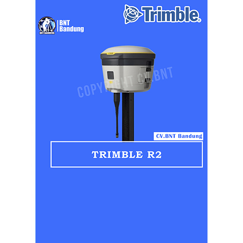
GPS Geodetik RTK GNSS Trimble R2

The Trimble® R2 is a compact, durable GNSS receiver that provides an easy-to-use solution for GIS and survey professionals who need to collect highly accurate data in a wide range of geospatial applications. Capable of delivering between submeter and centimeter positioning accuracy in real-time to any mobile device via a wireless Bluetooth® connection, the R2 receiver gives you total flexibility to choose a solution based on the accuracy and GNSS performance level that suits your application, letting you work the way you want.

  • Professional solution for GIS & survey applications ranging from submeter to centimeter accuracies
  • Easily collect data by pairing with devices such as smartphones, tablets or Trimble handhelds
  • Fast to setup, easy-to-use, keeping you productive and focused on your work
  • Supports multiple satellite constellations and correction sources for accurate data at any location
  • Compact, cable-free design with integrated antenna

High accuracy for survey & GIS applications

  • Capable of delivering submeter to centimeter level positioning accuracy in real-time to suit any field data collection application.
  • Achieve higher accuracy in real-time using correction sources from SBAS and VRS networks to Trimble RTX™ correction services*, delivered by either satellite or Internet, or via traditional RTK methods.
  • Supports multiple satellite constellations and augmentation systems to provide maximum accuracy and positioning performance.

* Trimble RTX available through Trimble applications

Flexible solution

  • Able to be paired with any mobile device on a variety of operating systems and platforms, from a Trimble handheld or controller to a modern smartphone or tablet.
  • You can select the accuracy and GNSS performance level appropriate for your application.
  • Capable of being operated either mounted on a pole, on a backpack or on a vehicle.
  • Integrates with Trimble software such as Trimble Access™, Trimble TerraFlex™ and Trimble Business Center to enable data to be easily collected, communicated and processed, providing you with high-quality deliverables for your organization.

Simple, rugged system

  • One-button start up and compact, streamlined design enables a quick setup.
  • Built to withstand tough conditions meeting military specifications MIL-810G for ruggedness and an IP65 rating.


Note:
*Harga Dapat Berubah Sewaktu – waktu tanpa pemberitahuan terlebih dahulu.
*Mohon tanya ketersediaan barang terlebih dahulu.
 

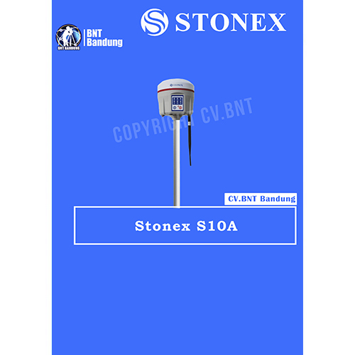
GPS Geodetik RTK GNSS Stonex S800A

Stonex S800A is a compact, high-performance GNSS receiver with unique features and unmatched in its category. The S800A features the multi constellation 600 channels GNSS board and supports GPS, GLONASS, BEIDOU, GALILEO, including L-Band correction.

The unique internal antenna combines GNSS, Bluetooth and Wi-Fi integrated modules to optimize space and increase performance. This technology provides stronger and cleaner signal monitoring, which means unprecedented results.
Designed for all day use in surveying application, S800A includes several features: Linux Operating System, WEB UI interface, UHF radio modem, high battery capacity and IP67 certification.

Stonex S800A GNSS receiver, thanks to aRTK function and service of Atlas® correction is an ideal solution for any surveying field work and in particular in difficult areas. Atlas® delivers world wide centimetre level correction data through L-band communication satellites and internet.

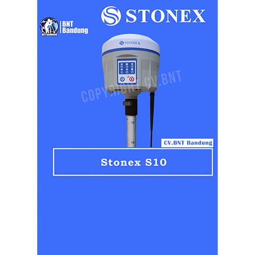
GPS Geodetik RTK GNSS Stonex S10

Spesifikasi Dan Fitur Gps Geodetik Stonex S10 GNSS Receiver RTK

Deskripsi:

The New Generation GNSS Receiver
Stonex S10, the most advanced integrated GNSS Receiver ever appeared on the geomatic scene, leads to a new generation of smart and open GPS, where the User has the ability to install customized applications directly on the receiver.

The advanced features of Stonesx S10, such as automatic leveling with electronic bubble, make surveying much faster and accurate.

The sophisticated internal structure design guarantees a compact housing: GNSS antenna, GPS board, power board, RX/TX radio, smart battery, 3.5G module, BT module and Wi-Fi module all take place in a well organized space, optimizing performances and power consumption.

Stonex S10 is based on CORTEX-A8 platform with on board LINUX smart system combined with an excellent networking system. With the provision of a special SDK package it is possible to develop and install special applications that run inside S10 ecosystem, enabling an unlimited range of advanced applications.

Fitur:

  • MULTI CONSTELLATION Stonex S10 with its 220 channels, provides an excellent on board real time navigation solution with high accuracy. All GNSS signals (GPS, GLONASS, BEIDOU and GALILEO) are included, no additional cost.
  • WEB UI CONTROL To initialize, manage, monitor the settings of the receiver and to download data using portable or PC, smartphone or tablet.
  • TILT CENTERING Its possible to measure points with inclination up to 30. The tilt compensator installed inside can automatically correct the coordinates of the points collected in accordance with the tilt angle and tilt direction of the range pole.
  • TWO INTELLIGENT BATTERIES Stonex S10 is delivered with two high capacity smart batteries. The power level can be checked from the controller and directly from a simple led bar on the battery by the simple press of a button.
  • RUGGED DESIGN IP67 PROTECTION IP67 certification, combined with a high shock resistance guarantee the maximum strength and the best water and dust tight even in harsh environments.


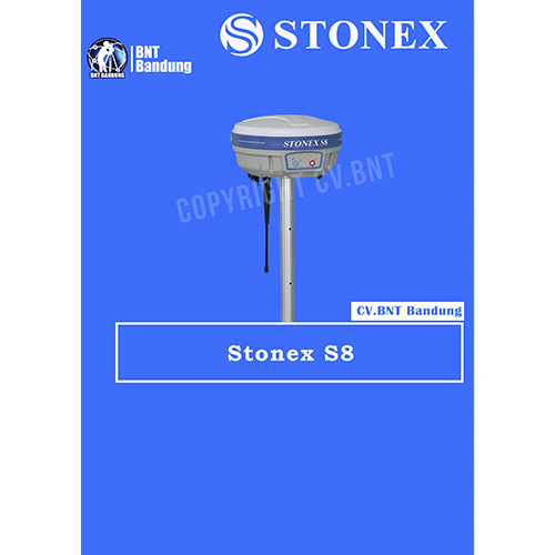
GPS Geodetik RTK GNSS Stonex S8

Spesifikasi Dan Fitur Gps Geodetik Stonex S8 GNSS Receivers RTK

The New Generation GNSS Receiver
Stonex S10, the most advanced integrated GNSS Receiver ever appeared on the geomatic scene, leads to a new generation of smart and open GPS, where the User has the ability to install customized applications directly on the receiver.

The advanced features of Stonesx S10, such as automatic leveling with electronic bubble, make surveying much faster and accurate.

The sophisticated internal structure design guarantees a compact housing: GNSS antenna, GPS board, power board, RX/TX radio, smart battery, 3.5G module, BT module and Wi-Fi module all take place in a well organized space, optimizing performances and power consumption.

Stonex S10 is based on CORTEX-A8 platform with on board LINUX smart system combined with an excellent networking system. With the provision of a special SDK package it is possible to develop and install special applications that run inside S10 ecosystem, enabling an unlimited range of advanced applications.

Fitur:

  • MULTI CONSTELLATION Stonex S10 with its 220 channels, provides an excellent on board real time navigation solution with high accuracy. All GNSS signals (GPS, GLONASS, BEIDOU and GALILEO) are included, no additional cost.
  • WEB UI CONTROL To initialize, manage, monitor the settings of the receiver and to download data using portable or PC, smartphone or tablet.
  • TILT CENTERING Its possible to measure points with inclination up to 30. The tilt compensator installed inside can automatically correct the coordinates of the points collected in accordance with the tilt angle and tilt direction of the range pole.
  • TWO INTELLIGENT BATTERIES Stonex S10 is delivered with two high capacity smart batteries. The power level can be checked from the controller and directly from a simple led bar on the battery by the simple press of a button.
  • RUGGED DESIGN IP67 PROTECTION IP67 certification, combined with a high shock resistance guarantee the maximum strength and the best water and dust tight even in harsh environments.

Note:
*Harga Dapat Berubah Sewaktu – waktu tanpa pemberitahuan terlebih dahulu.
*Mohon tanya ketersediaan barang terlebih dahulu.